|
search place name
|
||
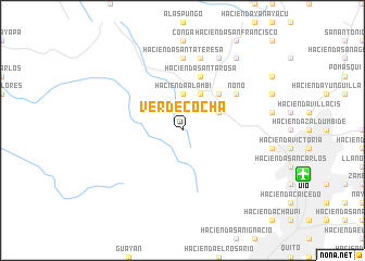
Verdecocha (Pichincha, Ecuador)Verdecocha is a town in the Pichincha region of Ecuador. An overview map of the region around Verdecocha is displayed below.
regional and 3d topo map of Verdecocha, Ecuador ::
Verdecocha airports ::
The nearest airport is UIO - Quito Mariscal Sucre Intl, located 13.2 km east of Verdecocha.
Other airports nearby include ATF - Ambato Chachoan (123.0 km south), TUA - Tulcan Teniente Coronel Luis A Mantilla (141.3 km north east), IPI - Ipiales San Luis (148.3 km north east), OCC - Coca Francisco De Orellana (184.0 km east), Nearby towns ::
Hacienda Alambi (3.7km north) //
Hacienda San Juan (4.1km north east) //
Hacienda La Campiña (4.1km north east) //
Hacienda San José (5.2km north east) //
Hacienda San Miguel (5.2km north east) //
Hacienda Santa Rosa (5.9km north) //
Nono (6.7km north east) //
Hacienda Santa Teresa (7.4km north) //
Chiquilpe (7.6km north) //
Calera (8.3km north east) //
Hacienda La Merced (9.3km north east) //
[all distances 'as the bird flies' and approximate] 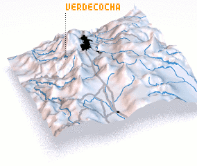 Places with similar names to Verdecocha, Ecuador ::
Disclaimer :: Information on this page comes without warranty of any kind |
||
|
Where is Verdecocha? Elevation and coordinates ::
Latitude (lat): 0°6'0"S Longitude (lon): 78°36'0"W
Elevation (approx.): 2999m (map arrows pan, magnifying glasses zoom) |
||
|
Visiting Verdecocha? Hotel/Accommodation ::
Book a hotel in Verdecocha Travel Guide ::
Buy a travel guide for Ecuador rental cars ::
car rental offers GPS waypoint ::
download a GPX waypoint (PoI) of Verdecocha for your GPS receiver
|
||