|
search place name
|
||
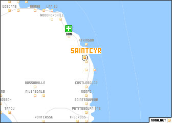
Saint Cyr (Saint David, Dominica)Saint Cyr is a town in the Saint David region of Dominica. An overview map of the region around Saint Cyr is displayed below.
regional and 3d topo map of Saint Cyr, Dominica ::
Saint Cyr airports ::
The nearest airport is DOM - Dominica Melville Hall, located 7.9 km north west of Saint Cyr.
Other airports nearby include DCF - Canefield (21.1 km south west), PTP - Pointe-a-pitre Le Raizet (91.1 km north), FDF - Fort-de-france Le Lamentin (102.7 km south), SLU - Castries George F L Charles (164.5 km south), Nearby towns ::
Salibia (0.0km north) //
Gaulette (0.0km north) //
Madjini (1.9km south) //
Crayfish River (1.9km north) //
Monkey Hill (1.9km north) //
Bataka (1.9km north) //
Sineku (2.6km south east) //
Atkinson (3.7km north) //
Castle Bruce (5.6km south) //
Marigot (6.6km north west) //
Morpo (7.4km south) //
[all distances 'as the bird flies' and approximate] 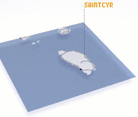 Places with similar names to Saint Cyr, Dominica ::
// Santa Isaura (BR)
// Zintsar (RU)
// Sundisar (BD)
// Sundisār (BD)
// Santa Sara (CL)
// Santa Sara (MX)
// Sandāsar (PK)
// Sandasarai (PK)
// Suntsar (PK)
// Saint-Cyr (HT)
Disclaimer :: Information on this page comes without warranty of any kind |
||
|
Where is Saint Cyr? Elevation and coordinates ::
Latitude (lat): 15°29'0"N Longitude (lon): 61°16'0"W
Elevation (approx.): 312m (map arrows pan, magnifying glasses zoom) |
||
|
Visiting Saint Cyr? Hotel/Accommodation ::
Book a hotel in Saint Cyr Travel Guide ::
Buy a travel guide for Dominica rental cars ::
car rental offers GPS waypoint ::
download a GPX waypoint (PoI) of Saint Cyr for your GPS receiver
|
||