|
search place name
|
||
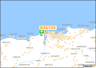
Aimutin 1 (Timor Timur, East Timor)Aimutin 1 is a town in the Timor Timur region of East Timor. An overview map of the region around Aimutin 1 is displayed below.
regional and 3d topo map of Aimutin 1, East Timor ::
Aimutin 1 airports ::
The nearest airport is DIL - Dili Presidente Nicolau Lobato Intl, located 2.6 km west of Aimutin 1.
Nearby towns ::
Lurumata (0.3km north east) //
Bedik (0.6km north east) //
Aimutin Laran (0.7km south west) //
Aimutin 2 (0.7km south) //
Markoni (0.8km north east) //
Pantaikelapa (0.9km north west) //
Pomento (1.0km west) //
Fatumeta (1.0km south east) //
Hudilaran (1.0km east) //
Mataruak (1.1km north east) //
Fatuhada (1.2km east) //
Bebunuk (1.3km north) //
Haslaran (1.2km south west) //
Kakaulidung (1.5km south east) //
Bairo Pite (1.5km east) //
Beto Timur (1.6km north west) //
Merdeka (1.7km west) //
Moro (1.7km east) //
Karketu (1.7km north east) //
Ailoklaran (1.8km south east) //
Paularan (1.9km north west) //
Manluana (2.0km west) //
Perumnas (2.1km south east) //
Bebora (2.1km east) //
Marinir (2.2km north west) //
Vila Verde (2.2km east) //
Aitarak (2.2km east) //
Manleoana (2.3km south) //
Kampungbaru (2.4km west) //
[all distances 'as the bird flies' and approximate] 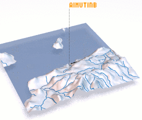 Places with similar names to Aimutin 1, East Timor ::
// Am Tanabo (TD)
Disclaimer :: Information on this page comes without warranty of any kind |
||
|
Where is Aimutin 1? Elevation and coordinates ::
Latitude (lat): 8°33'19"S Longitude (lon): 125°32'48"E
Elevation (approx.): 18m (map arrows pan, magnifying glasses zoom) |
||
|
Visiting Aimutin 1? Hotel/Accommodation ::
Book a hotel in Aimutin 1 Travel Guide ::
Buy a travel guide for East Timor rental cars ::
car rental offers GPS waypoint ::
download a GPX waypoint (PoI) of Aimutin 1 for your GPS receiver
|
||