|
search place name
|
||
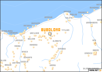
Buboloma (Timor Timur, East Timor)Buboloma is a town in the Timor Timur region of East Timor. An overview map of the region around Buboloma is displayed below.
regional and 3d topo map of Buboloma, East Timor ::
Buboloma airports ::
The nearest airport is DIL - Dili Presidente Nicolau Lobato Intl, located 128.3 km west of Buboloma.
Nearby towns ::
Riadae (0.4km east) //
Terobala (0.7km south) //
Samalalu (0.8km south west) //
Lauhare (0.9km south) //
Saelari (1.2km east) //
Lalulai (1.9km south west) //
Larisula (2.1km west) //
Samalari (2.4km west) //
Lariledana (2.4km east) //
Laucolo (2.5km north west) //
Sorogua (2.5km west) //
Alacafa (2.7km south) //
Lualari (2.7km north west) //
Loilaku (2.9km west) //
Bubodefo (3.1km west) //
Ulabute (3.5km south east) //
Beliwale (3.6km south east) //
Libagua (3.6km west) //
Lasula (3.8km south) //
Selegoa (3.9km south) //
Tirilolo (3.9km south west) //
Buskaulari (4.1km west) //
Nunira (4.1km west) //
Uaraba (4.2km south east) //
Samagata (4.2km south) //
Onebu (4.2km south) //
Borolau (4.5km west) //
Larimuta (4.5km west) //
Titilari (5.4km east) //
[all distances 'as the bird flies' and approximate] 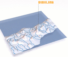 Places with similar names to Buboloma, East Timor ::
Disclaimer :: Information on this page comes without warranty of any kind |
||
|
Where is Buboloma? Elevation and coordinates ::
Latitude (lat): 8°29'5"S Longitude (lon): 126°41'17"E
Elevation (approx.): 532m (map arrows pan, magnifying glasses zoom) |
||
|
Visiting Buboloma? Hotel/Accommodation ::
Book a hotel in Buboloma Travel Guide ::
Buy a travel guide for East Timor rental cars ::
car rental offers GPS waypoint ::
download a GPX waypoint (PoI) of Buboloma for your GPS receiver
|
||