|
search place name
|
||
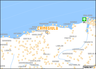
Caimegi Ulu (Timor Timur, East Timor)Caimegi Ulu is a town in the Timor Timur region of East Timor. An overview map of the region around Caimegi Ulu is displayed below.
regional and 3d topo map of Caimegi Ulu, East Timor ::
Caimegi Ulu airports ::
The nearest airport is DIL - Dili Presidente Nicolau Lobato Intl, located 15.3 km north east of Caimegi Ulu.
Nearby towns ::
Mauluto (0.7km north east) //
Klaso (0.9km north east) //
Caimegi (1.7km south west) //
Durubasa (2.3km south west) //
Leguimea (2.4km south west) //
Pissucaraik (2.4km west) //
Metir (3.0km south west) //
Bazartete (3.2km south west) //
Kumahu (3.2km west) //
Bazartete (3.3km south west) //
Metir (3.4km south west) //
Rauhassa (3.6km north west) //
Tuhilu Leten (3.9km south) //
Tuhilu Craic (4.0km south) //
Metaluli (4.2km south west) //
Motaikun (4.4km north east) //
Kamalehou (4.3km west) //
Metaluli (4.5km south west) //
Pisukaraik (4.6km north west) //
Kaitcho (4.9km north east) //
Buku Mera (5.0km south) //
Fatuneso (5.0km south) //
Kaileulema (5.0km south west) //
Pisulete (5.4km west) //
Kailelilema (5.5km south west) //
Kutulau (5.6km south) //
Lebuana (5.7km south west) //
Gerohata (5.9km north east) //
Nartutu (5.9km west) //
[all distances 'as the bird flies' and approximate] 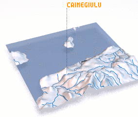 Places with similar names to Caimegi Ulu, East Timor ::
Disclaimer :: Information on this page comes without warranty of any kind |
||
|
Where is Caimegi Ulu? Elevation and coordinates ::
Latitude (lat): 8°35'58"S Longitude (lon): 125°23'48"E
Elevation (approx.): 172m (map arrows pan, magnifying glasses zoom) |
||
|
Visiting Caimegi Ulu? Hotel/Accommodation ::
Book a hotel in Caimegi Ulu Travel Guide ::
Buy a travel guide for East Timor rental cars ::
car rental offers GPS waypoint ::
download a GPX waypoint (PoI) of Caimegi Ulu for your GPS receiver
|
||