|
search place name
|
||
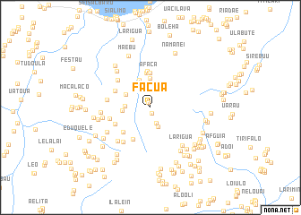
Facua (Timor Timur, East Timor)Facua is a town in the Timor Timur region of East Timor. An overview map of the region around Facua is displayed below.
regional and 3d topo map of Facua, East Timor ::
Facua airports ::
The nearest airport is DIL - Dili Presidente Nicolau Lobato Intl, located 118.7 km west of Facua.
Nearby towns ::
Gugolai (0.7km north) //
Maukiki (0.8km south) //
Culugia (0.8km north) //
Uadaboro (2.1km south) //
Uehuafa (2.3km north east) //
Daraloi (2.6km south) //
Loirae (2.6km north east) //
Muturo (2.7km north east) //
Uaitame (3.1km west) //
Wabere (3.4km north west) //
Uaitame (3.5km west) //
Barolai (3.6km north) //
Ucamuni (3.7km north) //
Afaca (4.3km north) //
Quelicai (4.4km north) //
Laumana (4.5km south west) //
Uecobuti (4.6km north) //
Uecobuti (4.6km north) //
Lacaliu (4.6km south west) //
Mumana (4.8km north west) //
Quelicai (4.9km south west) //
Butileo (5.2km west) //
Abafala (5.3km north west) //
Mucobubo (5.5km south west) //
Samadae (5.5km west) //
Uaule (5.9km south west) //
Lebene (6.0km west) //
Guruca (6.1km north west) //
Larigua (6.2km south east) //
[all distances 'as the bird flies' and approximate] 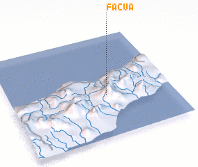 Places with similar names to Facua, East Timor ::
Disclaimer :: Information on this page comes without warranty of any kind |
||
|
Where is Facua? Elevation and coordinates ::
Latitude (lat): 8°35'2"S Longitude (lon): 126°36'7"E
Elevation (approx.): 609m (map arrows pan, magnifying glasses zoom) |
||
|
Visiting Facua? Hotel/Accommodation ::
Book a hotel in Facua Travel Guide ::
Buy a travel guide for East Timor rental cars ::
car rental offers GPS waypoint ::
download a GPX waypoint (PoI) of Facua for your GPS receiver
|
||