|
search place name
|
||
Fatukkabuarleten (Timor Timur, East Timor)Fatukkabuarleten is a town in the Timor Timur region of East Timor. An overview map of the region around Fatukkabuarleten is displayed below.
regional and 3d topo map of Fatukkabuarleten, East Timor ::

Fatukkabuarleten airports ::
The nearest airport is DIL - Dili Presidente Nicolau Lobato Intl, located 88.3 km north east of Fatukkabuarleten.
Nearby towns ::
Sou (1.2km south) //
Kusilulik (1.7km east) //
Wemer (3.1km east) //
Lorokida (4.2km south) //
Lawakau (4.5km east) //
Fatuloro (5.2km north east) //
Baukama (5.3km south) //
Maubesi (5.2km south west) //
Laktos (5.5km west) //
Klobor (5.7km west) //
Makous (5.8km north east) //
Aitoun (5.9km north west) //
Nularan (6.1km south west) //
Fatululik (6.7km north) //
Sadahor (6.7km south west) //
Taroman (6.8km north east) //
Beko (6.9km north) //
Fatubesi (6.9km south west) //
Fatukbitiklaran (6.9km south west) //
Lianain (7.1km north east) //
Fohorem (7.2km south west) //
Beibutuk (7.4km west) //
Fatuklaran (7.5km south west) //
Loohali (7.5km south west) //
Kulit (7.6km south) //
Oges (7.7km east) //
Manulor (8.1km north east) //
Holuhan (8.2km north east) //
Holpilat (8.2km east) //
[all distances 'as the bird flies' and approximate] 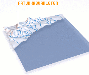 Places with similar names to Fatukkabuarleten, East Timor :: Disclaimer :: Information on this page comes without warranty of any kind |
||
|
Where is Fatukkabuarleten? Elevation and coordinates ::
Latitude (lat): 9°15'0"S Longitude (lon): 125°8'43"E
Elevation (approx.): 600m (map arrows pan, magnifying glasses zoom) |
||
|
Visiting Fatukkabuarleten? Hotel/Accommodation ::
Book a hotel in Fatukkabuarleten Travel Guide ::
Buy a travel guide for East Timor rental cars ::
car rental offers GPS waypoint ::
download a GPX waypoint (PoI) of Fatukkabuarleten for your GPS receiver
|
||