|
search place name
|
||
Gildapil (Timor Timur, East Timor)Gildapil is a town in the Timor Timur region of East Timor. An overview map of the region around Gildapil is displayed below.
regional and 3d topo map of Gildapil, East Timor ::

Gildapil airports ::
The nearest airport is DIL - Dili Presidente Nicolau Lobato Intl, located 72.2 km north east of Gildapil.
Nearby towns ::
Nandikole (0.4km west) //
Mabelis (0.7km south west) //
Ilpo (1.7km south west) //
Lebos (1.7km south) //
Tasmil (2.3km north east) //
Piron (2.6km south east) //
Ozo (3.1km east) //
Ibuk (3.3km south west) //
Sassa (3.6km north west) //
Halimutin (3.6km north east) //
Atus (3.6km north west) //
Hoololo (4.0km north west) //
Piebul (4.9km south west) //
Lebos (5.5km south east) //
Itililig (5.5km east) //
Lakmaras (6.0km west) //
Henes (6.2km south west) //
Lakus (6.2km west) //
Geleba (6.3km south west) //
Sabulmil (6.3km west) //
Besituu (6.5km south west) //
Lakmarastas (6.6km south west) //
Gumalolo (6.7km north west) //
Goigamasak (6.7km south west) //
Bucuk (6.9km north east) //
Buarat a Balili (6.8km north west) //
Zbais (6.8km west) //
Sontoi (6.9km north west) //
Holak (7.0km east) //
[all distances 'as the bird flies' and approximate] 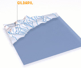 Places with similar names to Gildapil, East Timor ::
// Juldapil (ID)
Disclaimer :: Information on this page comes without warranty of any kind |
||
|
Where is Gildapil? Elevation and coordinates ::
Latitude (lat): 9°7'17"S Longitude (lon): 125°12'49"E
Elevation (approx.): 952m (map arrows pan, magnifying glasses zoom) |
||
|
Visiting Gildapil? Hotel/Accommodation ::
Book a hotel in Gildapil Travel Guide ::
Buy a travel guide for East Timor rental cars ::
car rental offers GPS waypoint ::
download a GPX waypoint (PoI) of Gildapil for your GPS receiver
|
||