|
search place name
|
||
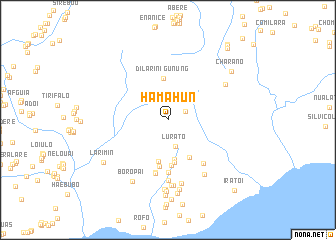
Hamahun (Timor Timur, East Timor)Hamahun is a town in the Timor Timur region of East Timor. An overview map of the region around Hamahun is displayed below.
regional and 3d topo map of Hamahun, East Timor ::
Hamahun airports ::
The nearest airport is DIL - Dili Presidente Nicolau Lobato Intl, located 143.5 km west of Hamahun.
Nearby towns ::
Caidabu (2.1km north east) //
Lurato (3.0km south) //
Cainliu (4.5km south) //
Gunung Dilarini (4.7km north) //
Liufalo (4.7km south) //
Maloira (4.8km south) //
Acaidoroloho (4.8km south east) //
Caidovalarin (5.0km south) //
Tatalalarin (5.3km south) //
Butinafa (5.8km south) //
Etevata (6.0km south) //
Tirilolo (6.1km south) //
Vataomar (6.2km south east) //
Titiravem (6.8km south) //
Bunabiqui (7.3km south) //
Fuat (7.3km south) //
Iliomar (7.3km south) //
Rumotau (7.3km south east) //
Locileu (7.5km north east) //
Ailebere (7.7km south) //
Leilor (7.8km south) //
Caintau (7.8km south) //
Boropai (7.9km south west) //
Uatamatar (8.0km south) //
Arara (8.2km south) //
Ossoira (8.4km south) //
Larimin (8.6km south west) //
Acara (8.8km south) //
Charano (8.9km north east) //
[all distances 'as the bird flies' and approximate] 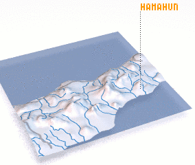 Places with similar names to Hamahun, East Timor :: Disclaimer :: Information on this page comes without warranty of any kind |
||
|
Where is Hamahun? Elevation and coordinates ::
Latitude (lat): 8°38'37"S Longitude (lon): 126°49'30"E
Elevation (approx.): 531m (map arrows pan, magnifying glasses zoom) |
||
|
Visiting Hamahun? Hotel/Accommodation ::
Book a hotel in Hamahun Travel Guide ::
Buy a travel guide for East Timor rental cars ::
car rental offers GPS waypoint ::
download a GPX waypoint (PoI) of Hamahun for your GPS receiver
|
||