|
search place name
|
||
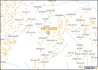
Hatusao (Timor Timur, East Timor)Hatusao is a town in the Timor Timur region of East Timor. An overview map of the region around Hatusao is displayed below.
regional and 3d topo map of Hatusao, East Timor ::
Hatusao airports ::
The nearest airport is DIL - Dili Presidente Nicolau Lobato Intl, located 35.3 km north of Hatusao.
Nearby towns ::
Caurema (0.8km south west) //
Kartolo (1.5km east) //
Erbean (2.3km north west) //
Rimori (2.5km north) //
Kanurema (2.5km north east) //
Qeorema (3.0km south west) //
Maulahulu (3.2km south) //
Lauhili (3.2km east) //
Bertai (3.4km north west) //
Hatululi (3.6km east) //
Bleheto (3.7km south) //
Lebotuto (3.8km east) //
Kaikasa (4.0km north west) //
Aihou (4.0km east) //
Mamude (4.0km west) //
Lekitei (4.2km east) //
Kolehunu (4.3km east) //
Manosahe (4.4km east) //
Tehtuko (4.6km north east) //
Manumerah (4.6km south east) //
Lekilakuana (4.7km north) //
Flisac (4.7km east) //
Kaulala (4.8km north east) //
Tatiri Lama (4.9km south) //
Mausoro Mata (4.9km south west) //
Keorudu (4.9km south west) //
Erhetu (5.1km north west) //
Hatobuilico (5.3km south west) //
Rileko (5.3km north east) //
[all distances 'as the bird flies' and approximate] 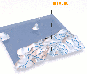 Places with similar names to Hatusao, East Timor ::
Disclaimer :: Information on this page comes without warranty of any kind |
||
|
Where is Hatusao? Elevation and coordinates ::
Latitude (lat): 8°51'50"S Longitude (lon): 125°33'21"E
Elevation (approx.): 1851m (map arrows pan, magnifying glasses zoom) |
||
|
Visiting Hatusao? Hotel/Accommodation ::
Book a hotel in Hatusao Travel Guide ::
Buy a travel guide for East Timor rental cars ::
car rental offers GPS waypoint ::
download a GPX waypoint (PoI) of Hatusao for your GPS receiver
|
||