|
search place name
|
||
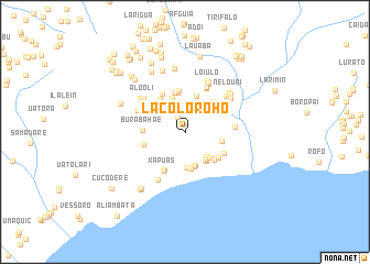
Lacoloroho (Timor Timur, East Timor)Lacoloroho is a town in the Timor Timur region of East Timor. An overview map of the region around Lacoloroho is displayed below.
regional and 3d topo map of Lacoloroho, East Timor ::
Lacoloroho airports ::
The nearest airport is DIL - Dili Presidente Nicolau Lobato Intl, located 128.5 km west of Lacoloroho.
Nearby towns ::
Maussoe (1.6km north west) //
Uato-Carbau (2.7km north) //
Uagabuta (2.7km north east) //
Betoria (3.4km south east) //
Taradae (3.5km south east) //
Tanalale (3.6km south) //
Cailorodi (3.6km south east) //
Uaniuma (3.7km south) //
Comaoli (3.7km south) //
Betoria (3.7km north) //
Irabinleteria (3.7km south east) //
Uatocarabau (3.8km south) //
Macaussa (3.8km north) //
Bualale (3.9km east) //
Afaloicai (4.0km north) //
Deralare (4.1km north) //
Uatodere (4.1km south east) //
Macaducarau (4.2km north west) //
Irabere (4.2km north east) //
Lecoala (4.2km north) //
Maraussa (4.3km south east) //
Burabahae (4.2km west) //
Kadilale (4.3km south west) //
Kailoloho (4.4km north east) //
Taradae (4.4km west) //
Marae (4.4km north east) //
Kapuas (4.5km south west) //
Bualale (4.5km north west) //
Irabinhooli (4.5km north east) //
[all distances 'as the bird flies' and approximate] 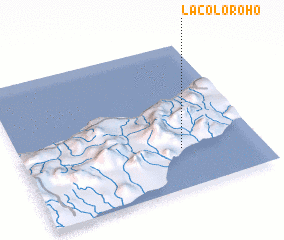 Places with similar names to Lacoloroho, East Timor :: Disclaimer :: Information on this page comes without warranty of any kind |
||
|
Where is Lacoloroho? Elevation and coordinates ::
Latitude (lat): 8°43'24"S Longitude (lon): 126°40'42"E
Elevation (approx.): 318m (map arrows pan, magnifying glasses zoom) |
||
|
Visiting Lacoloroho? Hotel/Accommodation ::
Book a hotel in Lacoloroho Travel Guide ::
Buy a travel guide for East Timor rental cars ::
car rental offers GPS waypoint ::
download a GPX waypoint (PoI) of Lacoloroho for your GPS receiver
|
||