|
search place name
|
||
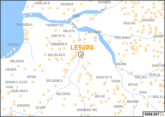
Lesupu (Timor Timur, East Timor)Lesupu is a town in the Timor Timur region of East Timor. An overview map of the region around Lesupu is displayed below.
regional and 3d topo map of Lesupu, East Timor ::
Lesupu airports ::
The nearest airport is DIL - Dili Presidente Nicolau Lobato Intl, located 46.5 km north east of Lesupu.
Nearby towns ::
Heda (1.6km north) //
Abuli (1.7km south east) //
Banedole (1.8km south) //
Peumate (1.8km west) //
Daarobu (1.9km north west) //
Dirularan (1.9km west) //
Loumate (2.1km north west) //
Hatubou (2.1km west) //
Lugu Teho (2.2km north west) //
Sabarakalara (2.4km south) //
Koilima (2.6km west) //
Aidabaraeabe (3.0km north) //
Airamasala (3.4km west) //
Paslete (3.5km south) //
Turema (3.5km north) //
Maumela (3.7km south) //
Poelete (4.0km south east) //
Fatubessi (4.3km north) //
Biadila (4.3km south) //
Dilatorobo (4.3km south east) //
Buloi (4.4km south west) //
Atabai (4.5km north west) //
Nunudoi (4.5km north) //
Ritiogoro (4.6km north) //
Atumate (4.6km west) //
Maleteten (4.7km north west) //
Lahululi (4.9km south west) //
Suruhati (4.9km south west) //
Aimia (5.1km north east) //
[all distances 'as the bird flies' and approximate]  Places with similar names to Lesupu, East Timor ::
Disclaimer :: Information on this page comes without warranty of any kind |
||
|
Where is Lesupu? Elevation and coordinates ::
Latitude (lat): 8°50'9"S Longitude (lon): 125°13'6"E
Elevation (approx.): 72m (map arrows pan, magnifying glasses zoom) |
||
|
Visiting Lesupu? Hotel/Accommodation ::
Book a hotel in Lesupu Travel Guide ::
Buy a travel guide for East Timor rental cars ::
car rental offers GPS waypoint ::
download a GPX waypoint (PoI) of Lesupu for your GPS receiver
|
||