|
search place name
|
||
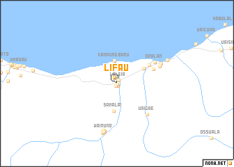
Lifau (Timor Timur, East Timor)Lifau is a town in the Timor Timur region of East Timor. An overview map of the region around Lifau is displayed below.
regional and 3d topo map of Lifau, East Timor ::
Lifau airports ::
The nearest airport is DIL - Dili Presidente Nicolau Lobato Intl, located 70.4 km west of Lifau.
Nearby towns ::
Ralan (0.2km south) //
Beboro (0.4km south) //
Umaiuk (0.5km south west) //
Laleia (0.5km north east) //
Kampung Baru (3.6km north) //
Samalai (4.4km south) //
Raha (4.9km north east) //
Vemasse (5.9km north east) //
Vemasse (6.2km east) //
Uaigae (6.9km south east) //
Oralan (6.9km north east) //
Caicua (7.3km east) //
Bahamori (7.7km north east) //
Raibua (7.8km south) //
Hatusili (7.9km south) //
Coroco (7.9km south) //
Wainuno (8.0km south) //
Raimea (8.1km south) //
Biaboe (8.3km south) //
Lor (8.8km north east) //
[all distances 'as the bird flies' and approximate] 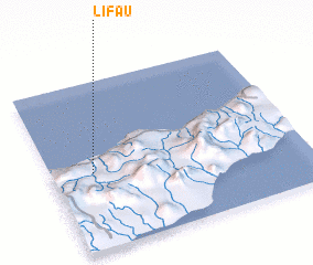 Places with similar names to Lifau, East Timor ::
Disclaimer :: Information on this page comes without warranty of any kind |
||
|
Where is Lifau? Elevation and coordinates ::
Latitude (lat): 8°32'15"S Longitude (lon): 126°9'51"E
Elevation (approx.): 55m (map arrows pan, magnifying glasses zoom) |
||
|
Visiting Lifau? Hotel/Accommodation ::
Book a hotel in Lifau Travel Guide ::
Buy a travel guide for East Timor rental cars ::
car rental offers GPS waypoint ::
download a GPX waypoint (PoI) of Lifau for your GPS receiver
|
||