|
search place name
|
||
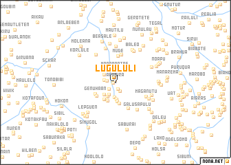
Lugululi (Timor Timur, East Timor)Lugululi is a town in the Timor Timur region of East Timor. An overview map of the region around Lugululi is displayed below.
regional and 3d topo map of Lugululi, East Timor ::
Lugululi airports ::
The nearest airport is DIL - Dili Presidente Nicolau Lobato Intl, located 57.0 km north east of Lugululi.
Nearby towns ::
Acubira (0.4km north) //
Ritiudu (0.4km west) //
Magalelor (1.1km south) //
Ritabou (1.4km west) //
Dirumdesan (1.5km south west) //
Maahui (1.6km south east) //
Koloana (1.9km west) //
Manapaatas (2.2km north) //
Samelau (2.2km north west) //
Raimaten (2.3km south west) //
Haubai (2.4km south) //
Maliana (2.6km south west) //
Ramaskora (2.7km south west) //
Lahomea (2.7km south) //
Diruabe (2.8km north west) //
Lesubotang (3.1km south) //
Oplegul (3.2km south west) //
Rokon (3.3km south west) //
Lesuboten (3.5km south) //
Solugolo (3.7km south west) //
Genuhaan (3.7km south west) //
Mude (4.3km north) //
Lisuabe (4.6km north) //
Raedolen (4.6km south east) //
Maganutu (5.4km south east) //
Beabubu (5.5km north west) //
Galusapulu (5.6km south east) //
Samutaben (5.7km north) //
Bereleu (5.8km north) //
[all distances 'as the bird flies' and approximate]  Places with similar names to Lugululi, East Timor ::
// La Colilla (ES)
// Lokololi (CD)
// Lukalela (CD)
// Lukolela (CD)
// Lukolela (CD)
// Lukolula (CD)
// Loukoléla (CG)
// Lequiloualo (TP)
// Lukulaulau (TP)
// Lugolole (UG)
Disclaimer :: Information on this page comes without warranty of any kind |
||
|
Where is Lugululi? Elevation and coordinates ::
Latitude (lat): 8°58'17"S Longitude (lon): 125°13'52"E
Elevation (approx.): 311m (map arrows pan, magnifying glasses zoom) |
||
|
Visiting Lugululi? Hotel/Accommodation ::
Book a hotel in Lugululi Travel Guide ::
Buy a travel guide for East Timor rental cars ::
car rental offers GPS waypoint ::
download a GPX waypoint (PoI) of Lugululi for your GPS receiver
|
||