|
search place name
|
||
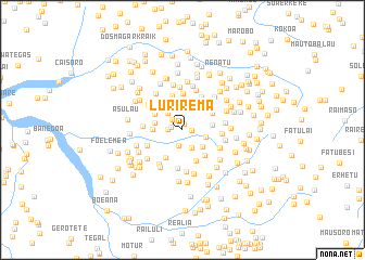
Lurirema (Timor Timur, East Timor)Lurirema is a town in the Timor Timur region of East Timor. An overview map of the region around Lurirema is displayed below.
regional and 3d topo map of Lurirema, East Timor ::
Lurirema airports ::
The nearest airport is DIL - Dili Presidente Nicolau Lobato Intl, located 31.3 km north east of Lurirema.
Nearby towns ::
Hatete (0.7km north) //
Gomhaei (1.0km east) //
Geroboti (1.2km west) //
Gaenoa (1.2km north) //
Bauana (1.5km west) //
Urado (1.5km north west) //
Lebutu (1.6km south) //
Regoa (2.1km south east) //
Aiprado (2.3km north west) //
Tititir (2.4km east) //
Manubobo (2.7km south east) //
Ducurai (2.9km west) //
Otete (3.1km west) //
Darhai (3.1km east) //
Poerema (3.2km north west) //
Talo (3.3km south west) //
Tidibesse (3.4km north east) //
Teuro (3.5km south east) //
Tatabaoria (3.5km north east) //
Aiceo (3.5km south east) //
Aitemua (3.7km north) //
Fatubolo (3.7km north) //
Poepung (3.8km north east) //
Loblala (3.9km north east) //
Samatrai (3.9km north east) //
Lelemanu (3.9km south west) //
Aihatadiu Leten (4.0km south) //
Betutu (4.1km west) //
Lauabe (4.1km east) //
[all distances 'as the bird flies' and approximate] 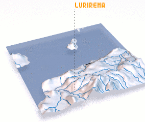 Places with similar names to Lurirema, East Timor :: Disclaimer :: Information on this page comes without warranty of any kind |
||
|
Where is Lurirema? Elevation and coordinates ::
Latitude (lat): 8°46'58"S Longitude (lon): 125°22'4"E
Elevation (approx.): 1185m (map arrows pan, magnifying glasses zoom) |
||
|
Visiting Lurirema? Hotel/Accommodation ::
Book a hotel in Lurirema Travel Guide ::
Buy a travel guide for East Timor rental cars ::
car rental offers GPS waypoint ::
download a GPX waypoint (PoI) of Lurirema for your GPS receiver
|
||