|
search place name
|
||
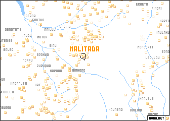
Malitada (Timor Timur, East Timor)Malitada is a town in the Timor Timur region of East Timor. An overview map of the region around Malitada is displayed below.
regional and 3d topo map of Malitada, East Timor ::
Malitada airports ::
The nearest airport is DIL - Dili Presidente Nicolau Lobato Intl, located 45.0 km north of Malitada.
Nearby towns ::
Ailisu (0.6km north west) //
Atubuti (0.6km north) //
Atupae (0.9km north east) //
Aliatu (1.1km north) //
Paramin (1.1km north) //
Airai (1.1km north) //
Laklo (1.2km north west) //
Acubuli (1.2km south east) //
Asio (1.3km north) //
Genutete (1.3km west) //
Atsabe (1.5km north west) //
Malabe (1.5km west) //
Tapoinea (1.6km north west) //
Atudose (1.9km north) //
Malimea (2.1km south west) //
Ilatkora (2.1km north west) //
Kailulik (2.3km north) //
Boboleta (2.3km north west) //
Raibuti (2.4km north west) //
Kolimali (2.5km north east) //
Lelobere (2.7km north) //
Lukowai (2.7km north west) //
Lauabe (2.9km north) //
Batumigi (3.0km north west) //
Koileki (3.3km north east) //
Biahoro (3.5km south) //
Tiarlelo (3.5km west) //
Ilat (3.5km north) //
Liabe (3.8km north east) //
[all distances 'as the bird flies' and approximate] 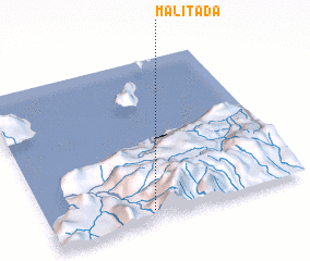 Places with similar names to Malitada, East Timor ::
// Melutut (MY)
// Moltedo (IT)
// Multedo (IT)
// Moldtua (NO)
// Małdyty (PL)
// Molatedi (ZA)
// Malyye Dydy (RU)
// Mladat' (RU)
// Muli-Datta (RU)
// Melitota (US)
Disclaimer :: Information on this page comes without warranty of any kind |
||
|
Where is Malitada? Elevation and coordinates ::
Latitude (lat): 8°56'10"S Longitude (lon): 125°24'20"E
Elevation (approx.): 1268m (map arrows pan, magnifying glasses zoom) |
||
|
Visiting Malitada? Hotel/Accommodation ::
Book a hotel in Malitada Travel Guide ::
Buy a travel guide for East Timor rental cars ::
car rental offers GPS waypoint ::
download a GPX waypoint (PoI) of Malitada for your GPS receiver
|
||