|
search place name
|
||
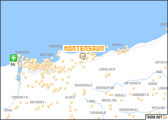
Montensaun (Timor Timur, East Timor)Montensaun is a town in the Timor Timur region of East Timor. An overview map of the region around Montensaun is displayed below.
regional and 3d topo map of Montensaun, East Timor ::
Montensaun airports ::
The nearest airport is DIL - Dili Presidente Nicolau Lobato Intl, located 15.5 km west of Montensaun.
Nearby towns ::
Motakik (0.6km south west) //
Besidada (0.7km north east) //
Berukulun (0.7km north east) //
Bidik (0.9km north) //
Jembatankik (1.0km north east) //
Airiti (1.1km south west) //
Liqirahu (1.2km north west) //
Caremon (1.5km south) //
Mantarlido (1.7km north) //
Ailoklaran (2.0km east) //
Bemanotolu (2.1km north east) //
Akanunu (2.1km west) //
Manoroni (2.1km north east) //
Hera (2.4km north east) //
Lepos (2.5km east) //
Lolesu (2.7km west) //
Beraka (2.8km north east) //
Raimia (3.0km south west) //
Susan (3.7km south west) //
Fatuahi (4.0km south west) //
Ailelehu (4.7km west) //
Bedois (4.7km west) //
Aidabahare (5.0km south west) //
Lakeru Laran (5.1km south west) //
Bedois (5.2km west) //
Lunukhun (5.4km west) //
Buburlau (5.8km south west) //
Pasirputih (5.8km west) //
Pasir Putih (5.9km north east) //
[all distances 'as the bird flies' and approximate] 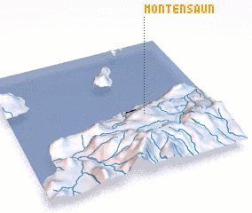 Places with similar names to Montensaun, East Timor ::
// Mountain Scene (US)
// Montenoison (FR)
Disclaimer :: Information on this page comes without warranty of any kind |
||
|
Where is Montensaun? Elevation and coordinates ::
Latitude (lat): 8°32'59"S Longitude (lon): 125°39'57"E
Elevation (approx.): 34m (map arrows pan, magnifying glasses zoom) |
||
|
Visiting Montensaun? Hotel/Accommodation ::
Book a hotel in Montensaun Travel Guide ::
Buy a travel guide for East Timor rental cars ::
car rental offers GPS waypoint ::
download a GPX waypoint (PoI) of Montensaun for your GPS receiver
|
||