|
search place name
|
||
Orema (Timor Timur, East Timor)Orema is a town in the Timor Timur region of East Timor. An overview map of the region around Orema is displayed below.
regional and 3d topo map of Orema, East Timor ::

Orema airports ::
The nearest airport is DIL - Dili Presidente Nicolau Lobato Intl, located 45.6 km north of Orema.
Nearby towns ::
Carbulau (1.9km south) //
Anilumu (2.0km north west) //
Blaro (2.2km north) //
Russu (2.4km east) //
Palitehu (2.4km south east) //
Datina (2.6km west) //
Fahiluhan (3.2km west) //
Deunai (3.5km north) //
Tirilolo (3.5km south) //
Fahiluhan (3.6km west) //
Fatuku (3.7km south) //
Hastetuk (3.9km east) //
Betulala (4.5km west) //
Same (5.2km south) //
Holarua (5.4km south) //
Batas (5.5km east) //
Ailau (5.5km east) //
Haturae (5.7km south) //
Airakalau (5.8km north west) //
Bubulau (5.9km east) //
Raiubu (6.0km south) //
Tomanamo (6.3km south west) //
Ailuli (6.4km south) //
Socemera (6.4km south east) //
Maulau (6.5km north) //
Dalun (6.8km south east) //
Kotalala (6.9km south) //
Tutu Luro (6.9km east) //
Manico (7.1km south) //
[all distances 'as the bird flies' and approximate] 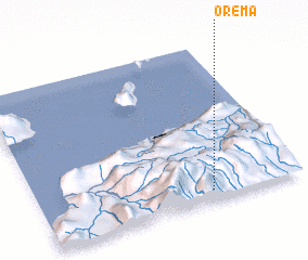 Places with similar names to Orema, East Timor ::
Disclaimer :: Information on this page comes without warranty of any kind |
||
|
Where is Orema? Elevation and coordinates ::
Latitude (lat): 8°56'15"S Longitude (lon): 125°39'20"E
Elevation (approx.): 1167m (map arrows pan, magnifying glasses zoom) |
||
|
Visiting Orema? Hotel/Accommodation ::
Book a hotel in Orema Travel Guide ::
Buy a travel guide for East Timor rental cars ::
car rental offers GPS waypoint ::
download a GPX waypoint (PoI) of Orema for your GPS receiver
|
||