|
search place name
|
||
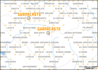
Guanacaste (San Miguel, El Salvador)Guanacaste is a town in the San Miguel region of El Salvador. An overview map of the region around Guanacaste is displayed below.
regional and 3d topo map of Guanacaste, El Salvador ::
Guanacaste airports ::
The nearest airport is SAL - San Salvador El Salvador Intl, located 90.3 km west of Guanacaste.
Other airports nearby include TGU - Tegucigalpa Toncontin Intl (120.2 km east), SAP - San Pedro Sula La Mesa Intl (192.3 km north), LCE - La Ceiba Goloson Intl (268.9 km north east), Nearby towns ::
Ciudad Barrios (2.6km north east) //
Nuevo Porvenir (3.7km south) //
San Luisito (3.6km west) //
San Matías (4.1km north east) //
El Cirigual (4.1km south east) //
La Angostura (4.1km south west) //
Coyotera (4.1km south west) //
Apapuerta (4.1km north west) //
San Juan (4.1km south west) //
Belén (4.0km north west) //
Llano El Ángel (5.6km north) //
La Puerta (5.8km north) //
Agua Zarca (5.8km south) //
Joya Grande (5.8km south) //
El Carrizal (6.6km north east) //
El Carrizal (6.6km north east) //
Los Abelines (6.6km south east) //
Las Quebradas (6.5km north east) //
Finca La Angostura (6.5km north east) //
La Majada (6.6km south west) //
Teponaguaste (6.6km north west) //
El Picacho (6.6km north west) //
Las Mesas (6.6km south west) //
Charlaca (7.2km west) //
El Porvenir (7.4km south) //
La Cruz (7.4km south) //
San Juan (7.4km north) //
Volcancillo (7.4km north) //
La Isleta (7.4km east) //
[all distances 'as the bird flies' and approximate] 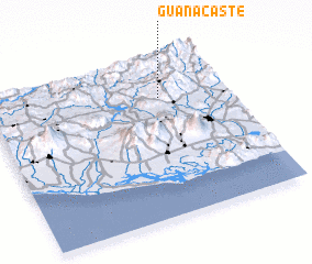 Places with similar names to Guanacaste, El Salvador ::
Disclaimer :: Information on this page comes without warranty of any kind |
||
|
Where is Guanacaste? Elevation and coordinates ::
Latitude (lat): 13°45'0"N Longitude (lon): 88°17'0"W
Elevation (approx.): 843m (map arrows pan, magnifying glasses zoom) |
||
|
Visiting Guanacaste? Hotel/Accommodation ::
Book a hotel in Guanacaste Travel Guide ::
Buy a travel guide for El Salvador rental cars ::
car rental offers GPS waypoint ::
download a GPX waypoint (PoI) of Guanacaste for your GPS receiver
|
||