|
search place name
|
||
San Miguel Tepezontes (La Paz, El Salvador)San Miguel Tepezontes is a town in the La Paz region of El Salvador. An overview map of the region around San Miguel Tepezontes is displayed below.
regional and 3d topo map of San Miguel Tepezontes, El Salvador ::

San Miguel Tepezontes airports ::
The nearest airport is SAL - San Salvador El Salvador Intl, located 20.4 km south of San Miguel Tepezontes.
Other airports nearby include GUA - Guatemala City La Aurora (194.3 km north west), TGU - Tegucigalpa Toncontin Intl (201.0 km east), SAP - San Pedro Sula La Mesa Intl (234.5 km north east), CBV - Coban (253.0 km north west), Nearby towns ::
San Juan Tepezontes (1.6km south east) //
La Esperanza (3.4km south east) //
San José La Montaña (3.5km west) //
El Socorro (3.7km south) //
Soledad Las Flores (4.3km east) //
Concepción Lourdes (4.3km east) //
Los Laureles (4.8km south east) //
El Limar (5.0km west) //
Santa Cruz La Vega (5.0km west) //
San Antonio La Loma (5.2km south) //
San Emigdio (5.1km north east) //
San José Costa Rica (5.1km north east) //
La Cruz (6.0km south east) //
San Bartolo (5.9km east) //
El Copinol (5.9km east) //
Paraíso de Osorio (6.0km east) //
San Antonio Masahuat (6.4km south) //
Hacienda Vieja (6.4km south east) //
Belén (6.6km south) //
San Antonio Panchimilama (7.1km west) //
Santa Cruz Chacastal (7.4km south east) //
Santa Rita Almendro (7.4km south east) //
San Pedro La Palma (7.8km south west) //
San Isidro (7.7km east) //
San José La Ceiba (7.9km north east) //
El Rosario (7.9km north east) //
San Antonio (7.9km north east) //
Candelaria (7.9km north east) //
Las Lajas (7.9km south west) //
[all distances 'as the bird flies' and approximate] 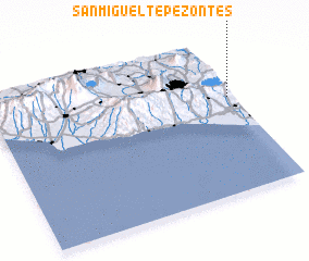 Places with similar names to San Miguel Tepezontes, El Salvador :: Disclaimer :: Information on this page comes without warranty of any kind |
||
|
Where is San Miguel Tepezontes? Elevation and coordinates ::
Latitude (lat): 13°37'21"N Longitude (lon): 89°1'17"W
Elevation (approx.): 769m (map arrows pan, magnifying glasses zoom) |
||
|
Visiting San Miguel Tepezontes? Hotel/Accommodation ::
Book a hotel in San Miguel Tepezontes Travel Guide ::
Buy a travel guide for El Salvador rental cars ::
car rental offers GPS waypoint ::
download a GPX waypoint (PoI) of San Miguel Tepezontes for your GPS receiver
|
||