|
search place name
|
||
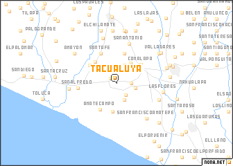
Tacualuya (La Paz, El Salvador)Tacualuya is a town in the La Paz region of El Salvador. An overview map of the region around Tacualuya is displayed below.
regional and 3d topo map of Tacualuya, El Salvador ::
Tacualuya airports ::
The nearest airport is SAL - San Salvador El Salvador Intl, located 7.0 km south east of Tacualuya.
Other airports nearby include GUA - Guatemala City La Aurora (196.2 km north west), TGU - Tegucigalpa Toncontin Intl (214.8 km east), SAP - San Pedro Sula La Mesa Intl (253.6 km north east), CBV - Coban (261.3 km north west), Nearby towns ::
Santo Tomás (1.3km north west) //
Santa Clara (2.3km south east) //
San Luis Talpa (2.3km east) //
Zambombera (2.9km south east) //
Veracruz (3.1km north) //
Nuevo Edén (3.1km east) //
Jayuca (3.5km north west) //
San Juan Talpa (3.9km north east) //
La Esmeralda (4.6km south) //
El Porvenir (4.6km south) //
Planes de Las Delicias (4.8km north west) //
San José Buena Vista (4.9km north) //
Tobalón (4.9km north) //
Comalapa (4.8km north east) //
Amatecampo (4.9km south west) //
Santa Lucía La Barranca (5.2km north west) //
Santa Fe (5.4km north west) //
San Alfredo (6.1km west) //
San Antonio (6.6km north) //
Astoria (7.1km east) //
San Francisco Amatepe (7.3km south east) //
Las Flores (7.3km east) //
San Sebastián (7.5km north) //
Cangrejera (7.5km west) //
El Paredón (8.1km north east) //
Amayón (8.2km north west) //
Cuyultitán (8.4km north) //
El Carmen (8.2km east) //
Los Guachipilines (8.5km north) //
[all distances 'as the bird flies' and approximate] 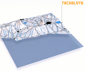 Places with similar names to Tacualuya, El Salvador ::
Disclaimer :: Information on this page comes without warranty of any kind |
||
|
Where is Tacualuya? Elevation and coordinates ::
Latitude (lat): 13°28'26"N Longitude (lon): 89°6'38"W
Elevation (approx.): 35m (map arrows pan, magnifying glasses zoom) |
||
|
Visiting Tacualuya? Hotel/Accommodation ::
Book a hotel in Tacualuya Travel Guide ::
Buy a travel guide for El Salvador rental cars ::
car rental offers GPS waypoint ::
download a GPX waypoint (PoI) of Tacualuya for your GPS receiver
|
||