|
search place name
|
||
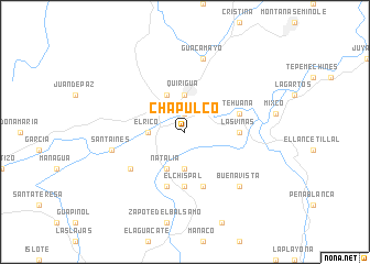
Chapulco (Izabal, Guatemala)Chapulco is a town in the Izabal region of Guatemala. An overview map of the region around Chapulco is displayed below.
regional and 3d topo map of Chapulco, Guatemala ::
Chapulco airports ::
The nearest airport is SAP - San Pedro Sula La Mesa Intl, located 126.9 km east of Chapulco.
Other airports nearby include CBV - Coban (144.5 km west), GUA - Guatemala City La Aurora (171.2 km south west), TEA - Tela (182.6 km east), SAL - San Salvador El Salvador Intl (198.3 km south), Nearby towns ::
Molina (1.9km north) //
Beatriz (3.7km south) //
El Rico (3.6km west) //
Quiriguá (3.7km north) //
Natalia (4.1km south west) //
Los Amates (4.1km north west) //
El Chispal (5.6km south) //
Las Viñas (5.4km east) //
Champona (5.8km south) //
Chispal (5.8km south) //
Tehuana (5.7km east) //
Bañadero Colorado (6.5km south west) //
Santa Inés (7.4km west) //
Guacamayo (7.6km north) //
Buena Vista (7.7km south east) //
[all distances 'as the bird flies' and approximate] 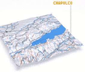 Places with similar names to Chapulco, Guatemala ::
// Chepelki (RU)
// Chupaleyka (RU)
// Chapilca (CL)
// Chapulaco (MX)
// Chapulco (MX)
// Chapeluko (ZM)
// Chipillico (PE)
// Chip Lake (CA)
// Shpilʼki (BY)
// Chapulco (MX)
Disclaimer :: Information on this page comes without warranty of any kind |
||
|
Where is Chapulco? Elevation and coordinates ::
Latitude (lat): 15°14'0"N Longitude (lon): 89°5'0"W
Elevation (approx.): 96m (map arrows pan, magnifying glasses zoom) |
||
|
Visiting Chapulco? Hotel/Accommodation ::
Book a hotel in Chapulco Travel Guide ::
Buy a travel guide for Guatemala rental cars ::
car rental offers GPS waypoint ::
download a GPX waypoint (PoI) of Chapulco for your GPS receiver
|
||