|
search place name
|
||
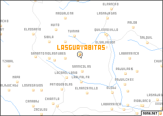
Las Guayabitas (Huehuetenango, Guatemala)Las Guayabitas is a town in the Huehuetenango region of Guatemala. An overview map of the region around Las Guayabitas is displayed below.
regional and 3d topo map of Las Guayabitas, Guatemala ::
Las Guayabitas airports ::
The nearest airport is CBV - Coban, located 106.6 km east of Las Guayabitas.
Other airports nearby include TAP - Tapachula Intl (127.0 km south west), GUA - Guatemala City La Aurora (134.2 km south east), TGZ - Tuxtla Gutierrez Angel Albino Corzo (213.1 km north west), Nearby towns ::
San Nicolás (3.1km south) //
Ixquiac (3.6km west) //
El Rancho (5.1km north west) //
Tuinimá (5.3km north) //
La Alfalfa (5.6km south) //
La Capellanía (5.6km south west) //
El Salvador (6.0km north east) //
Páquix (6.0km west) //
San Antonio Las Nubes (7.1km west) //
Chancol (7.7km north east) //
Quilén Novillo (7.7km north east) //
El Manzanillo (8.2km south) //
Sibilá (8.0km north west) //
Patio de Bolas (8.5km south west) //
Huito (8.6km north west) //
El Suj (10.5km south east) //
[all distances 'as the bird flies' and approximate] 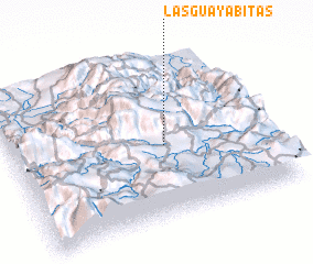 Places with similar names to Las Guayabitas, Guatemala ::
// Los Guayabitos (PA)
// Las Guayabitas (GT)
// Las Guayabitas (VE)
// Las Guayabitas (VE)
// Los Guayabitos (VE)
// Los Guayabitos (VE)
Disclaimer :: Information on this page comes without warranty of any kind |
||
|
Where is Las Guayabitas? Elevation and coordinates ::
Latitude (lat): 15°27'0"N Longitude (lon): 91°24'0"W
Elevation (approx.): 3165m (map arrows pan, magnifying glasses zoom) |
||
|
Visiting Las Guayabitas? Hotel/Accommodation ::
Book a hotel in Las Guayabitas Travel Guide ::
Buy a travel guide for Guatemala rental cars ::
car rental offers GPS waypoint ::
download a GPX waypoint (PoI) of Las Guayabitas for your GPS receiver
|
||