|
search place name
|
||
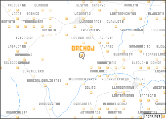
Orchoj (Jalapa, Guatemala)Orchoj is a town in the Jalapa region of Guatemala. An overview map of the region around Orchoj is displayed below.
regional and 3d topo map of Orchoj, Guatemala ::
Orchoj airports ::
The nearest airport is GUA - Guatemala City La Aurora, located 58.8 km west of Orchoj.
Other airports nearby include CBV - Coban (111.4 km north west), SAL - San Salvador El Salvador Intl (158.4 km south east), Nearby towns ::
El Salitre (1.9km north) //
Quebraditas (2.6km south east) //
Los Tablones (3.7km north) //
El Rodeo (4.0km south east) //
El Mojón (5.2km north east) //
Río Blanco (5.2km south east) //
Ingenio de Ayarza (5.6km south) //
Las Lomitas (5.8km north) //
Las Moritas (5.7km east) //
Mal Paso (5.7km east) //
San Antonio (5.7km east) //
Salfate (6.5km north east) //
Garay (6.5km south east) //
Las Tapias (6.5km south east) //
Arloroma (6.6km north west) //
Laguna Verde (6.6km south west) //
Los Achiotes (7.4km east) //
Casa de Tablas (7.4km east) //
Llano Grande (7.6km north) //
Golito (7.6km south) //
La Aurora (7.6km north) //
Morazán (8.1km south east) //
Piedras de Fuego (9.1km south east) //
Urlanta (9.1km north west) //
San Carlos Alzatate (10.1km south west) //
El Maestrillo (10.3km north east) //
Guajilote (10.3km north east) //
El Carmen (10.3km south east) //
El Paraíso (10.3km north west) //
[all distances 'as the bird flies' and approximate]  Places with similar names to Orchoj, Guatemala :: Disclaimer :: Information on this page comes without warranty of any kind |
||
|
Where is Orchoj? Elevation and coordinates ::
Latitude (lat): 14°33'0"N Longitude (lon): 89°59'0"W
Elevation (approx.): 1134m (map arrows pan, magnifying glasses zoom) |
||
|
Visiting Orchoj? Hotel/Accommodation ::
Book a hotel in Orchoj Travel Guide ::
Buy a travel guide for Guatemala rental cars ::
car rental offers GPS waypoint ::
download a GPX waypoint (PoI) of Orchoj for your GPS receiver
|
||