|
search place name
|
||
Pacoj (Chimaltenango, Guatemala)Pacoj is a town in the Chimaltenango region of Guatemala. An overview map of the region around Pacoj is displayed below.
regional and 3d topo map of Pacoj, Guatemala ::

Pacoj airports ::
The nearest airport is GUA - Guatemala City La Aurora, located 31.3 km south east of Pacoj.
Other airports nearby include CBV - Coban (83.6 km north east), TAP - Tapachula Intl (176.2 km west), SAL - San Salvador El Salvador Intl (234.2 km south east), Nearby towns ::
La Cruz (0.0km north) //
Tioxyá (0.0km north) //
Pacá (0.0km north) //
Estancia de La Virgen (0.0km north) //
Los Xalín (1.8km east) //
Chitún (1.8km east) //
Chicastellanos (1.8km east) //
Chidonjuan (1.8km east) //
Cuchuyá (1.9km south) //
Ajbalché (1.9km north) //
San Miguel (1.9km north) //
Pacojito (1.9km north) //
Chiuleu (1.8km west) //
Paquixjuyú (1.8km west) //
Pacoxpom (2.6km north east) //
La Laguna (2.6km north east) //
Chuachunub (2.6km north east) //
Chicojom (2.6km north east) //
Panatzán (2.6km north east) //
Cuchuyá (2.6km south west) //
San Antonio Las Trojes (3.5km south east) //
Chuaxán (3.7km north) //
Xejuyú (3.6km west) //
Platanar (3.6km west) //
Naranjo (3.6km west) //
Patuyú (3.6km west) //
Los Gálvez (4.0km north east) //
Escobitas (4.0km north east) //
Santa Teresita (4.0km north west) //
[all distances 'as the bird flies' and approximate] 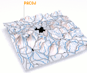 Places with similar names to Pacoj, Guatemala ::
// Pokój (PL)
// Pokoje (PL)
// Paikojai I (LT)
// Paikojai II (LT)
// Pecaj (AL)
// Pogaj (AL)
// Pečuj (BA)
// Pekija (BA)
// Pekije (BA)
// Pokoj (BA)
Disclaimer :: Information on this page comes without warranty of any kind |
||
|
Where is Pacoj? Elevation and coordinates ::
Latitude (lat): 14°47'0"N Longitude (lon): 90°44'0"W
Elevation (approx.): 1586m (map arrows pan, magnifying glasses zoom) |
||
|
Visiting Pacoj? Hotel/Accommodation ::
Book a hotel in Pacoj Travel Guide ::
Buy a travel guide for Guatemala rental cars ::
car rental offers GPS waypoint ::
download a GPX waypoint (PoI) of Pacoj for your GPS receiver
|
||