|
search place name
|
||
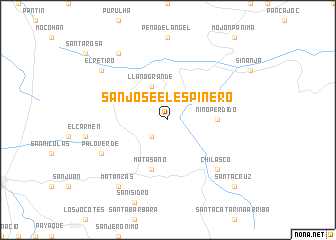
San José El Espinero (Baja Verapaz, Guatemala)San José El Espinero is a town in the Baja Verapaz region of Guatemala. An overview map of the region around San José El Espinero is displayed below.
regional and 3d topo map of San José El Espinero, Guatemala ::
San José El Espinero airports ::
The nearest airport is CBV - Coban, located 43.3 km north west of San José El Espinero.
Other airports nearby include GUA - Guatemala City La Aurora (76.3 km south west), SAL - San Salvador El Salvador Intl (224.5 km south east), Nearby towns ::
Cumbre del Carpintero (2.6km south west) //
La Unión Barrios (4.1km north west) //
Llano Grande (4.1km north west) //
Niño Perdido (5.4km east) //
Matasano (5.8km south) //
Chilascó (7.7km south east) //
Palo Verde (8.1km south west) //
Panimá (9.2km north west) //
El Retiro (9.1km north west) //
Matanzas (9.2km south west) //
Santa Cruz (10.3km south east) //
[all distances 'as the bird flies' and approximate]  Places with similar names to San José El Espinero, Guatemala :: Disclaimer :: Information on this page comes without warranty of any kind |
||
|
Where is San José El Espinero? Elevation and coordinates ::
Latitude (lat): 15°10'0"N Longitude (lon): 90°9'0"W
Elevation (approx.): 1420m (map arrows pan, magnifying glasses zoom) |
||
|
Visiting San José El Espinero? Hotel/Accommodation ::
Book a hotel in San José El Espinero Travel Guide ::
Buy a travel guide for Guatemala rental cars ::
car rental offers GPS waypoint ::
download a GPX waypoint (PoI) of San José El Espinero for your GPS receiver
|
||