|
search place name
|
||
Santa Isabel (Chimaltenango, Guatemala)Santa Isabel is a town in the Chimaltenango region of Guatemala. An overview map of the region around Santa Isabel is displayed below.
regional and 3d topo map of Santa Isabel, Guatemala ::

Santa Isabel airports ::
The nearest airport is GUA - Guatemala City La Aurora, located 31.4 km east of Santa Isabel.
Other airports nearby include CBV - Coban (96.7 km north east), TAP - Tapachula Intl (169.5 km west), SAL - San Salvador El Salvador Intl (233.2 km south east), Nearby towns ::
Bola de Oro (1.9km north) //
El Rosario (1.9km north) //
Cerro Alto (1.9km north) //
Chimaltenango (2.4km south west) //
Ciénaga Grande (2.6km north east) //
El Tejar (4.0km south) //
Pacoc (4.0km north west) //
Mancherén Chiquito (4.0km north west) //
San Jacinto (4.1km north east) //
Mancherén Grande (5.2km north west) //
Buena Vista (5.7km west) //
Las Lomas (5.7km west) //
Las Colmenas (5.7km west) //
Pixcayá (5.8km north) //
Tonajuyú (5.8km north) //
Cambalcol (5.8km north) //
San Miguel Morazán (6.6km south east) //
San José Las Minas (6.6km north west) //
Santa Marta (7.2km east) //
Chirijuyú (7.4km west) //
Los Pocitos (7.6km north) //
Los Tablones (7.6km north) //
Xiquín Sanai (7.7km north west) //
Paraxaj (7.7km north west) //
San Lorenzo El Tejar (8.2km south east) //
Puerta Abajo (8.1km south west) //
Panucuy (8.2km north west) //
Pachitur (8.1km north west) //
Rancho Quemado (8.1km north east) //
[all distances 'as the bird flies' and approximate] 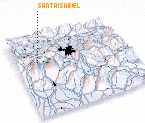 Places with similar names to Santa Isabel, Guatemala ::
// Santa Isabel (BR)
// Santa Isabel (BR)
// Santa Isabel (BR)
// Santa Isabel (BR)
// Santa Isabel (BR)
// Santa Isabel (BR)
// Santa Isabel (BR)
// Santa Isabel (BR)
// Santa Isabel (BR)
// Santa Isabel (BR)
Disclaimer :: Information on this page comes without warranty of any kind |
||
|
Where is Santa Isabel? Elevation and coordinates ::
Latitude (lat): 14°41'0"N Longitude (lon): 90°48'0"W
Elevation (approx.): 1743m (map arrows pan, magnifying glasses zoom) |
||
|
Visiting Santa Isabel? Hotel/Accommodation ::
Book a hotel in Santa Isabel Travel Guide ::
Buy a travel guide for Guatemala rental cars ::
car rental offers GPS waypoint ::
download a GPX waypoint (PoI) of Santa Isabel for your GPS receiver
|
||