|
search place name
|
||
Santa Teresa (San Marcos, Guatemala)Santa Teresa is a town in the San Marcos region of Guatemala. An overview map of the region around Santa Teresa is displayed below.
regional and 3d topo map of Santa Teresa, Guatemala ::

Santa Teresa airports ::
The nearest airport is TAP - Tapachula Intl, located 72.2 km west of Santa Teresa.
Other airports nearby include GUA - Guatemala City La Aurora (137.8 km east), CBV - Coban (151.7 km east), TGZ - Tuxtla Gutierrez Angel Albino Corzo (221.5 km north west), Nearby towns ::
Cerro Grande (0.0km north) //
Pancho de León (1.8km east) //
Río Hondo (1.9km north) //
Piedra Parada (2.6km south east) //
Corinto Zacualpa (2.6km north west) //
Santo Domingo (3.6km east) //
Tojchina (3.7km south) //
San Antonio Sacatepéquez (3.7km south) //
San Lorenzo (3.7km north) //
Siete Tambores (3.7km south) //
San Miguel (4.1km south east) //
Santa Rita (4.1km south west) //
Chamac (4.1km south west) //
San José Caben (4.0km south west) //
Yerbabuena (5.2km south west) //
La Cruz Chiquita (5.2km south west) //
Los Jazmines (5.2km south west) //
San Pedro Sacatepéquez (5.2km south west) //
San Andrés Chápil (5.4km west) //
La Grandeza (5.4km west) //
Potrerillos (5.4km east) //
Tuichilupe (5.8km north) //
Colonia Chiquita (5.7km east) //
Siquibal (5.8km south) //
Llano Grande (5.8km south) //
La Tenería (6.5km south west) //
Santa Irene (6.6km south east) //
Río Blanco (6.5km north east) //
Champollap (6.6km south west) //
[all distances 'as the bird flies' and approximate] 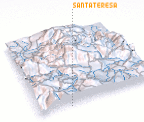 Places with similar names to Santa Teresa, Guatemala ::
// Santa Teresa (BR)
// Santa Teresa (BR)
// Santa Teresa (BR)
// Santa Teresa (BR)
// Santa Teresa (BR)
// Santa Teresa (BR)
// Santa Teresa (BR)
// Santa Teresa (BR)
// Santa Teresa (BR)
// Santa Teresa (BR)
Disclaimer :: Information on this page comes without warranty of any kind |
||
|
Where is Santa Teresa? Elevation and coordinates ::
Latitude (lat): 15°0'0"N Longitude (lon): 91°44'0"W
Elevation (approx.): 2737m (map arrows pan, magnifying glasses zoom) |
||
|
Visiting Santa Teresa? Hotel/Accommodation ::
Book a hotel in Santa Teresa Travel Guide ::
Buy a travel guide for Guatemala rental cars ::
car rental offers GPS waypoint ::
download a GPX waypoint (PoI) of Santa Teresa for your GPS receiver
|
||