|
search place name
|
||
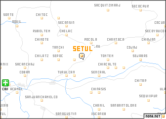
Setul (Alta Verapaz, Guatemala)Setul is a town in the Alta Verapaz region of Guatemala. An overview map of the region around Setul is displayed below.
regional and 3d topo map of Setul, Guatemala ::
Setul airports ::
The nearest airport is CBV - Coban, located 17.6 km west of Setul.
Other airports nearby include GUA - Guatemala City La Aurora (107.5 km south), Nearby towns ::
Bancab (1.8km west) //
Chicojil (2.6km north east) //
Caquitón (2.6km north east) //
Chiqueleu (2.6km north east) //
Sebob (4.1km north east) //
Pocolá (4.1km north east) //
San Pedro Carchá (4.1km south west) //
Sencaal (5.1km south east) //
Tupulcán (5.1km south west) //
Sepoc (5.4km west) //
Tomtem (5.4km east) //
Tanchí (5.7km west) //
Chiacalté (5.7km east) //
Chelac (6.6km north west) //
Chiyó (7.4km east) //
Seubub (7.6km south) //
Secansín (8.2km north west) //
Chinasis (8.2km south east) //
Chamtacá (8.0km north east) //
[all distances 'as the bird flies' and approximate] 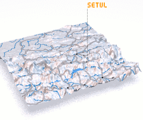 Places with similar names to Setul, Guatemala ::
Disclaimer :: Information on this page comes without warranty of any kind |
||
|
Where is Setul? Elevation and coordinates ::
Latitude (lat): 15°31'0"N Longitude (lon): 90°15'0"W
Elevation (approx.): 1352m (map arrows pan, magnifying glasses zoom) |
||
|
Visiting Setul? Hotel/Accommodation ::
Book a hotel in Setul Travel Guide ::
Buy a travel guide for Guatemala rental cars ::
car rental offers GPS waypoint ::
download a GPX waypoint (PoI) of Setul for your GPS receiver
|
||