|
search place name
|
||
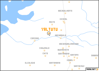
Yaltutú (Petén, Guatemala)Yaltutú is a town in the Petén region of Guatemala. An overview map of the region around Yaltutú is displayed below.
regional and 3d topo map of Yaltutú, Guatemala ::
Yaltutú airports ::
The nearest airport is CBV - Coban, located 142.9 km south west of Yaltutú.
Other airports nearby include BZE - Belize City Philip S W Goldson Intl (177.6 km north east), SAP - San Pedro Sula La Mesa Intl (197.2 km south east), GUA - Guatemala City La Aurora (230.2 km south west), Nearby towns ::
Poxté (4.2km north) //
Machaquilá (4.1km east) //
Santo Domingo (4.7km north east) //
Concomá (5.7km west) //
Chojimula (5.9km south) //
Las Delicias (6.8km south east) //
Chaquiex (7.3km north east) //
Ixcoxol (7.3km north east) //
Chitó (7.8km south) //
Buena Vista (8.1km south east) //
Hacienda El Ranchón (8.1km south east) //
Santa María (9.4km south east) //
Boca del Monte (10.2km north east) //
Poptún (10.4km south east) //
[all distances 'as the bird flies' and approximate] 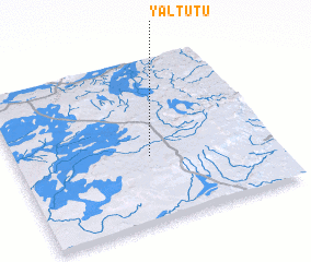
Disclaimer :: Information on this page comes without warranty of any kind |
||
|
Where is Yaltutú? Elevation and coordinates ::
Latitude (lat): 16°24'2"N Longitude (lon): 89°28'58"W
Elevation (approx.): 408m (map arrows pan, magnifying glasses zoom) |
||
|
Visiting Yaltutú? Hotel/Accommodation ::
Book a hotel in Yaltutú Travel Guide ::
Buy a travel guide for Guatemala rental cars ::
car rental offers GPS waypoint ::
download a GPX waypoint (PoI) of Yaltutú for your GPS receiver
|
||