|
search place name
|
||
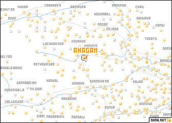
Āhagām (Jammu and Kashmīr, India)Āhagām is a town in the Jammu and Kashmīr region of India. An overview map of the region around Āhagām is displayed below.
regional and 3d topo map of Āhagām, India ::
Āhagām airports ::
The nearest airport is MFG - Muzaffarabad, located 63.7 km west of Āhagām.
Other airports nearby include SXR - Srinagar (70.2 km south east), RAZ - Rawala Kot Rawalakot (71.3 km south west), ISB - Islamabad Chaklala (133.6 km south west), GIL - Gilgit (169.0 km north), Nearby towns ::
Zachaldor (0.3km north) //
Wārapur (1.2km south west) //
Sultānpur (1.5km north) //
Nildogar (1.8km south) //
Yamrad (1.9km south) //
Chanjimul (1.8km south west) //
Hamla (2.2km north west) //
Rājpor (2.0km west) //
Khaipur (2.5km north east) //
Turkapur (2.6km north east) //
Yamrad Badiyān (3.1km south) //
Laribal (3.0km south west) //
Krumhur (3.4km north) //
Badarkal (3.0km east) //
Lachhipur (3.3km north east) //
Badalpur (3.3km east) //
Dudipur (3.7km north east) //
Shaikhpur (3.7km north east) //
Bowan (4.0km south west) //
Sarmarg (3.9km north west) //
Nagrādnār (3.8km south east) //
Wadapur (3.7km east) //
Chalpur (3.8km north east) //
Gūri Ākhar (3.9km east) //
Nabadzab (4.3km east) //
Shatagām (4.6km south west) //
Chākpur (5.0km north east) //
Golipur (4.7km west) //
Sanzīpura (5.6km south) //
[all distances 'as the bird flies' and approximate]  Places with similar names to Āhagām, India :: Disclaimer :: Information on this page comes without warranty of any kind |
||
|
Where is Āhagām? Elevation and coordinates ::
Latitude (lat): 34°24'0"N Longitude (lon): 74°11'50"E
Elevation (approx.): 1675m (map arrows pan, magnifying glasses zoom) |
||
|
Visiting Āhagām? Hotel/Accommodation ::
Book a hotel in Āhagām Travel Guide ::
Buy a travel guide for India rental cars ::
car rental offers GPS waypoint ::
download a GPX waypoint (PoI) of Āhagām for your GPS receiver
|
||