|
search place name
|
||
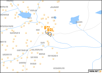
Bāl (Rājasthān, India)Bāl is a town in the Rājasthān region of India. An overview map of the region around Bāl is displayed below.
regional and 3d topo map of Bāl, India ::
Bāl airports ::
The nearest airport is KTU - Kota, located 53.4 km south of Bāl.
Other airports nearby include JAI - Jaipur (132.7 km north), UDR - Udaipur (215.5 km south west), Nearby towns ::
Rānipura (1.0km north east) //
Bāl (1.3km north west) //
Banjāron ki Jhonpariyān (2.1km south west) //
Rāta Barda (2.2km north) //
Thākron ki Jhonpariyān (2.4km south) //
Shankarpura (3.1km south) //
Thaliyān (3.1km north) //
Rādhāpur (3.0km north west) //
Rīshanda (3.4km north) //
Thaliyān (3.9km north) //
Barāgaon (4.3km south) //
Tār ka Khera (4.3km north west) //
Sūri (4.3km south west) //
Tākla (4.8km north) //
Rān (4.5km west) //
Pīpalwāsa (4.7km north west) //
Nayāgaon (5.2km north) //
Weir (5.9km north) //
Tākla (6.0km north) //
Sāmbharwāri (6.3km south) //
Kumarla (6.7km north) //
Lohāriya (6.5km north west) //
Sarsod (6.6km north west) //
Bālāpura (7.2km north) //
Bhairopura (7.1km north) //
Lahāriya (7.2km north west) //
Akoliya (6.9km west) //
Hulāspura (7.5km south west) //
Borda (8.0km south) //
[all distances 'as the bird flies' and approximate] 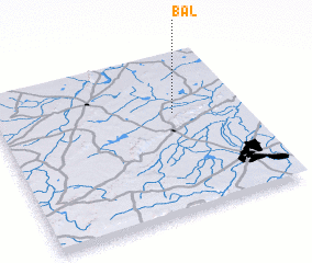 Places with similar names to Bāl, India ::
Disclaimer :: Information on this page comes without warranty of any kind |
||
|
Where is Bāl? Elevation and coordinates ::
Latitude (lat): 25°37'45"N Longitude (lon): 75°43'19"E
Elevation (approx.): 263m (map arrows pan, magnifying glasses zoom) |
||
|
Visiting Bāl? Hotel/Accommodation ::
Book a hotel in Bāl Travel Guide ::
Buy a travel guide for India rental cars ::
car rental offers GPS waypoint ::
download a GPX waypoint (PoI) of Bāl for your GPS receiver
|
||