|
search place name
|
||
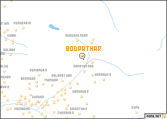
Bodpathar (Jammu and Kashmīr, India)Bodpathar is a town in the Jammu and Kashmīr region of India. An overview map of the region around Bodpathar is displayed below.
regional and 3d topo map of Bodpathar, India ::
Bodpathar airports ::
The nearest airport is SXR - Srinagar, located 46.7 km south west of Bodpathar.
Other airports nearby include RAZ - Rawala Kot Rawalakot (123.3 km south west), MFG - Muzaffarabad (135.1 km west), GIL - Gilgit (181.2 km north), IXJ - Jammu (187.3 km south), Nearby towns ::
Nāra Nāg (1.0km south east) //
Kanzil (1.8km east) //
Narāyannāg (2.6km south) //
Trunkhal (3.0km north) //
Hāpatsari (3.9km south east) //
Chitardalau (4.0km north) //
Mungshungan (4.5km north) //
Hamdalau (4.8km north) //
Gulābpathar (5.5km south) //
Haladorīn (5.5km south) //
Wāngat (5.8km south west) //
Harāmukh (5.8km south east) //
Pālapathar (6.2km south west) //
Wanyeāram (6.8km south) //
Chak Halīmkhān (7.6km south west) //
Dardawār (8.3km south) //
Kachhgund (7.9km south west) //
Peth Khānan (8.3km south west) //
Tsondar (8.2km south west) //
Laimlun (8.7km south west) //
Khānan (9.0km south west) //
Kachh-i-Nambal (10.1km south west) //
[all distances 'as the bird flies' and approximate]  Places with similar names to Bodpathar, India ::
// Bodpathar (IN)
Disclaimer :: Information on this page comes without warranty of any kind |
||
|
Where is Bodpathar? Elevation and coordinates ::
Latitude (lat): 34°22'25"N Longitude (lon): 74°58'35"E
Elevation (approx.): 3276m (map arrows pan, magnifying glasses zoom) |
||
|
Visiting Bodpathar? Hotel/Accommodation ::
Book a hotel in Bodpathar Travel Guide ::
Buy a travel guide for India rental cars ::
car rental offers GPS waypoint ::
download a GPX waypoint (PoI) of Bodpathar for your GPS receiver
|
||