|
search place name
|
||
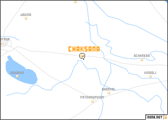
Chak Sāna (Rājasthān, India)Chak Sāna is a town in the Rājasthān region of India. An overview map of the region around Chak Sāna is displayed below.
regional and 3d topo map of Chak Sāna, India ::
Chak Sāna airports ::
The nearest airport is AGR - Agra, located 31.0 km east of Chak Sāna.
Other airports nearby include GWL - Gwalior (114.1 km south east), DEL - Delhi Indira Gandhi Intl (162.5 km north), JAI - Jaipur (186.7 km west), PGH - Nainital Pantnagar (272.3 km north east), Nearby towns ::
Bharkol (8.9km south east) //
[all distances 'as the bird flies' and approximate]  Places with similar names to Chak Sāna, India ::
// Chukson (US)
// Choczeń (PL)
// Chocznia (PL)
// Shixini (ZA)
// Shaykh Ḩusayn (IQ)
// Chāy Kasan (IR)
// Sheikh Hasan (ET)
// Chak Sonāi (BD)
// Chuaxán (GT)
// Chuaxán (GT)
Disclaimer :: Information on this page comes without warranty of any kind |
||
|
Where is Chak Sāna? Elevation and coordinates ::
Latitude (lat): 27°11'0"N Longitude (lon): 77°39'0"E
Elevation (approx.): 174m (map arrows pan, magnifying glasses zoom) |
||
|
Visiting Chak Sāna? Hotel/Accommodation ::
Book a hotel in Chak Sāna Travel Guide ::
Buy a travel guide for India rental cars ::
car rental offers GPS waypoint ::
download a GPX waypoint (PoI) of Chak Sāna for your GPS receiver
|
||