|
search place name
|
||
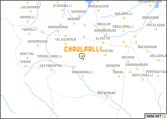
Chaulpalli (Andhra Pradesh, India)Chaulpalli is a town in the Andhra Pradesh region of India. An overview map of the region around Chaulpalli is displayed below.
regional and 3d topo map of Chaulpalli, India ::
Chaulpalli airports ::
The nearest airport is HYD - Hyderabad, located 58.6 km north east of Chaulpalli.
Other airports nearby include BEP - Bellary (246.6 km south west), Nearby towns ::
Chinchod (2.6km south west) //
Kāmsānpalli (3.7km south) //
Pidikiryāl (4.7km east) //
Mughalgidda (5.2km north) //
Yelkicherla (5.3km north west) //
Elkatta (5.7km north east) //
Srīrangapur (6.6km north west) //
Annāram (6.7km east) //
Sardārnagar (7.4km north east) //
Kotta Āgiryāl (7.3km west) //
Tangallapalli (7.3km west) //
Bodampahād (7.8km north) //
Kakulūr (8.3km north east) //
Manmari (8.5km north) //
Mahadeopur (8.5km north west) //
Rāikal (8.4km south east) //
Byrampalli (9.4km north west) //
Bālānagar (9.8km south east) //
[all distances 'as the bird flies' and approximate]  Places with similar names to Chaulpalli, India ::
// Chāleh Pīl (IR)
// Chāleh Pol (IR)
// Chāleh Polī (IR)
// Shell Pile (US)
// Challapalle (IN)
// Chilapilla (MX)
// Chalpollo (PE)
// Chilopola (MW)
Disclaimer :: Information on this page comes without warranty of any kind |
||
|
Where is Chaulpalli? Elevation and coordinates ::
Latitude (lat): 17°2'33"N Longitude (lon): 78°7'13"E
Elevation (approx.): 622m (map arrows pan, magnifying glasses zoom) |
||
|
Visiting Chaulpalli? Hotel/Accommodation ::
Book a hotel in Chaulpalli Travel Guide ::
Buy a travel guide for India rental cars ::
car rental offers GPS waypoint ::
download a GPX waypoint (PoI) of Chaulpalli for your GPS receiver
|
||