|
search place name
|
||
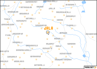
Jāla (Andhra Pradesh, India)Jāla is a town in the Andhra Pradesh region of India. An overview map of the region around Jāla is displayed below.
regional and 3d topo map of Jāla, India ::
Jāla airports ::
The nearest airport is HYD - Hyderabad, located 59.3 km south west of Jāla.
Other airports nearby include VGA - Vijayawada (243.2 km south east), Nearby towns ::
Pāmkunta (1.8km south) //
Korwāram (1.7km east) //
Singāwaram (3.6km north west) //
Dakuntapalli (4.1km north east) //
Rājāpet (4.8km south) //
Pārpalli (4.7km south east) //
Sālwāpur (5.6km north west) //
Lingampalli (5.8km north) //
Bendgai (5.7km east) //
Kannai (6.3km north east) //
Renkunta (6.6km south) //
Namle (6.8km south east) //
Keswāpur (7.2km north) //
Begampett (8.0km south) //
Gandamarla (8.1km south west) //
Daulāpur (8.0km west) //
Watipalli (8.2km north west) //
Sabāsgūdam (9.1km north) //
Nāgireddipalli (9.4km north east) //
Chatlapalli (9.7km north west) //
Gangāpur (10.3km north east) //
Venkatāpur (10.7km south east) //
[all distances 'as the bird flies' and approximate] 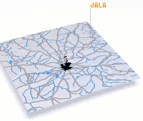 Places with similar names to Jāla, India ::
Disclaimer :: Information on this page comes without warranty of any kind |
||
|
Where is Jāla? Elevation and coordinates ::
Latitude (lat): 17°46'32"N Longitude (lon): 78°54'50"E
Elevation (approx.): 486m (map arrows pan, magnifying glasses zoom) |
||
|
Visiting Jāla? Hotel/Accommodation ::
Book a hotel in Jāla Travel Guide ::
Buy a travel guide for India rental cars ::
car rental offers GPS waypoint ::
download a GPX waypoint (PoI) of Jāla for your GPS receiver
|
||