|
search place name
|
||
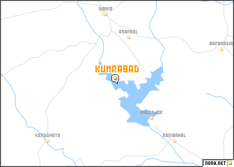
Kumrābād (Jharkhand, India)Kumrābād is a town in the Jharkhand region of India. An overview map of the region around Kumrābād is displayed below.
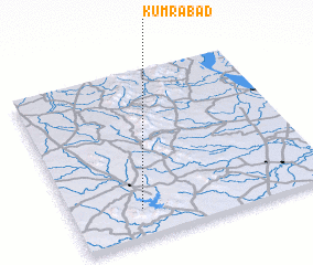
regional and 3d topo map of Kumrābād, India ::
Kumrābād airports ::
The nearest airport is DBO - Dhanbad, located 93.2 km south west of Kumrābād.
Other airports nearby include RJH - Rajshahi Shah Mokhdum (140.3 km east), IRD - Ishurdi (181.2 km east), IXW - Jamshedpur (187.2 km south west), CCU - Calcutta Netaji Subhash Chandra Bose Intl (206.4 km south east), Nearby towns ::
 Places with similar names to Kumrābād, India ::
// Kum-Rabad (UZ)
// Kum-Rabad (UZ)
// Kum-Rabat (UZ)
// Kamarābād (IR)
// Cumarebito (VE)
// Cambara Boído (GW)
Disclaimer :: Information on this page comes without warranty of any kind |
||
|
Where is Kumrābād? Elevation and coordinates ::
Latitude (lat): 24°10'0"N Longitude (lon): 87°16'0"E
Elevation (approx.): 121m (map arrows pan, magnifying glasses zoom) |
||
|
Visiting Kumrābād? Hotel/Accommodation ::
Book a hotel in Kumrābād Travel Guide ::
Buy a travel guide for India rental cars ::
car rental offers GPS waypoint ::
download a GPX waypoint (PoI) of Kumrābād for your GPS receiver
|
||