|
search place name
|
||
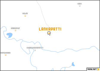
Lankapatti (Assam, India)Lankapatti is a town in the Assam region of India. An overview map of the region around Lankapatti is displayed below.
regional and 3d topo map of Lankapatti, India ::
Lankapatti airports ::
The nearest airport is IXS - Silchar, located 113.1 km south of Lankapatti.
Other airports nearby include JRH - Jorhat (151.0 km north east), ZYL - Sylhet Osmani Osmany Intl (153.0 km south west), IMF - Imphal (161.2 km south east), IXI - Lilabari (189.3 km north east), Nearby towns ::
Khārikhānapatti (7.5km south west) //
[all distances 'as the bird flies' and approximate]  Places with similar names to Lankapatti, India ::
// Longpadi (ID)
// Linquipata (PE)
// Llinquipata (PE)
// Longopito (KE)
// Loung Pát (VN)
// Liangpodi (CN)
Disclaimer :: Information on this page comes without warranty of any kind |
||
|
Where is Lankapatti? Elevation and coordinates ::
Latitude (lat): 25°56'0"N Longitude (lon): 92°57'0"E
Elevation (approx.): 83m (map arrows pan, magnifying glasses zoom) |
||
|
Visiting Lankapatti? Hotel/Accommodation ::
Book a hotel in Lankapatti Travel Guide ::
Buy a travel guide for India rental cars ::
car rental offers GPS waypoint ::
download a GPX waypoint (PoI) of Lankapatti for your GPS receiver
|
||