|
search place name
|
||
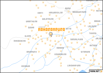
Maharāmpura (Rājasthān, India)Maharāmpura is a town in the Rājasthān region of India. An overview map of the region around Maharāmpura is displayed below.
regional and 3d topo map of Maharāmpura, India ::
Maharāmpura airports ::
The nearest airport is KTU - Kota, located 34.2 km south east of Maharāmpura.
Other airports nearby include JAI - Jaipur (164.0 km north), UDR - Udaipur (189.3 km south west), Nearby towns ::
Lākho ki Jhonpariyān (0.2km west) //
Hajāri Bhairu ki Jhonpariyān (1.1km north west) //
Pākhalpuriya (1.6km south) //
Khera (1.5km south west) //
Karjana (1.7km east) //
Sālarya (1.8km south west) //
Byāsbāvdi (1.9km south east) //
Shrīnagar (2.2km north west) //
Tīkhāwāra (2.6km north west) //
Kachhīpura (2.7km north east) //
Khānkhera (2.5km east) //
Āmli (3.1km south) //
Gopālniwās (2.9km south east) //
Sīlor (3.0km north east) //
Kumhāriyān (3.1km south east) //
Jawāharnagar (3.2km south west) //
Kawarpura (3.6km south) //
Bhīmpura (3.3km east) //
Mandāvara (3.5km south west) //
Garnāra (3.5km west) //
Rūpnagar (3.5km west) //
Mangāl (3.6km north west) //
Bhawānīpura (4.1km north) //
Bāvdīkhera (4.2km south east) //
Kanjarpura (4.5km north west) //
Bhalasva (4.6km north) //
Prempura (4.7km south) //
Kālpurīya (4.4km east) //
Sīnta (4.4km west) //
[all distances 'as the bird flies' and approximate] 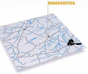 Places with similar names to Maharāmpura, India :: Disclaimer :: Information on this page comes without warranty of any kind |
||
|
Where is Maharāmpura? Elevation and coordinates ::
Latitude (lat): 25°21'30"N Longitude (lon): 75°35'9"E
Elevation (approx.): 256m (map arrows pan, magnifying glasses zoom) |
||
|
Visiting Maharāmpura? Hotel/Accommodation ::
Book a hotel in Maharāmpura Travel Guide ::
Buy a travel guide for India rental cars ::
car rental offers GPS waypoint ::
download a GPX waypoint (PoI) of Maharāmpura for your GPS receiver
|
||