|
search place name
|
||
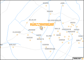
Muazzamnagar (Haryāna, India)Muazzamnagar is a town in the Haryāna region of India. An overview map of the region around Muazzamnagar is displayed below.
regional and 3d topo map of Muazzamnagar, India ::
Muazzamnagar airports ::
The nearest airport is DEL - Delhi Indira Gandhi Intl, located 52.7 km south east of Muazzamnagar.
Other airports nearby include IXC - Chandigarh (189.0 km north), DED - Dehra Dun Dehradun (189.1 km north east), LUH - Ludhiaha Ludhiana (225.1 km north), AGR - Agra (230.3 km south east), Nearby towns ::
Ridhāo (1.5km north east) //
Farmāna (1.8km north) //
Nizāmpur Mājra (1.8km north west) //
Gurar (3.5km south) //
Mahīpur (3.7km north east) //
Jasrāna (4.0km west) //
Silāna (4.7km south east) //
Bilbilān (4.8km north west) //
Bakheta (5.2km south) //
Bidhlān (5.3km south east) //
Salemsar Mājra (5.9km north east) //
Polangi (6.0km west) //
Mungān (6.4km south west) //
Nakloi (6.2km east) //
Ānwali (6.8km north west) //
Sisānah (7.8km south) //
Mohāna (7.9km north east) //
Nirthān (7.2km east) //
Sehri (7.5km south east) //
[all distances 'as the bird flies' and approximate] 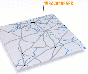 Places with similar names to Muazzamnagar, India ::
// Māsimnagar (BD)
Disclaimer :: Information on this page comes without warranty of any kind |
||
|
Where is Muazzamnagar? Elevation and coordinates ::
Latitude (lat): 28°58'8"N Longitude (lon): 76°48'59"E
Elevation (approx.): 228m (map arrows pan, magnifying glasses zoom) |
||
|
Visiting Muazzamnagar? Hotel/Accommodation ::
Book a hotel in Muazzamnagar Travel Guide ::
Buy a travel guide for India rental cars ::
car rental offers GPS waypoint ::
download a GPX waypoint (PoI) of Muazzamnagar for your GPS receiver
|
||