|
search place name
|
||
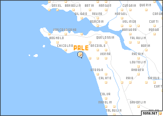
Pale (India)Pale is a town in India. An overview map of the region around Pale is displayed below.
regional and 3d topo map of Pale, India ::
Pale airports ::
The nearest airport is GOI - Goa, located 5.1 km north west of Pale.
Other airports nearby include IXG - Belgaum (98.4 km north east), KLH - Kolhapur (152.4 km north), Nearby towns ::
Velcao (1.8km east) //
Cuelim (3.6km east) //
Cortalim (4.1km north east) //
Sancoale (4.0km north east) //
Chicolna (4.0km north west) //
Utorda (5.1km south east) //
Verna (5.4km east) //
Dabolim (5.6km north) //
Consua (5.7km east) //
Nuvem (6.5km south east) //
Bogmolo (6.5km north west) //
Quelossim (6.5km north east) //
Chicalim (6.6km north west) //
Vāsco Da Gāma (6.6km north west) //
Vaddem (6.6km north west) //
Calate (7.7km south east) //
Betalbatim (7.7km south east) //
Agacaim (8.2km north east) //
Marmagao (9.1km north west) //
[all distances 'as the bird flies' and approximate] 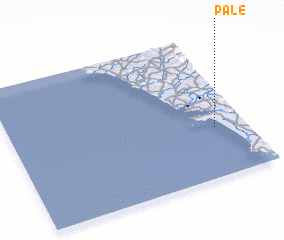 Places with similar names to Pale, India ::
Disclaimer :: Information on this page comes without warranty of any kind |
||
|
Where is Pale? Elevation and coordinates ::
Latitude (lat): 15°21'0"N Longitude (lon): 73°52'0"E
Elevation (approx.): -32768m (map arrows pan, magnifying glasses zoom) |
||
|
Visiting Pale? Hotel/Accommodation ::
Book a hotel in Pale Travel Guide ::
Buy a travel guide for India rental cars ::
car rental offers GPS waypoint ::
download a GPX waypoint (PoI) of Pale for your GPS receiver
|
||