|
search place name
|
||
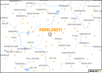
Pāmalparti (Andhra Pradesh, India)Pāmalparti is a town in the Andhra Pradesh region of India. An overview map of the region around Pāmalparti is displayed below.
regional and 3d topo map of Pāmalparti, India ::
Pāmalparti airports ::
The nearest airport is HYD - Hyderabad, located 42.5 km south west of Pāmalparti.
Nearby towns ::
Ippalguda (1.7km north east) //
Fāmalparti (2.3km north) //
Taddarpalli (2.5km south west) //
Mamdāla (3.1km south) //
Markūk (3.4km south east) //
Bālimpur (4.0km south west) //
Gaurāram (4.5km west) //
Cheparti (4.5km east) //
Sirgarpalli (5.7km north east) //
Kishtāpur (5.6km north east) //
Mutrāspalli (6.2km north) //
Venkatāpur (6.6km south east) //
Chaudarpalli (6.7km west) //
Timmaipalli (7.4km north) //
Narsampalli (7.5km south west) //
Akāram (7.5km north east) //
Maiiāram (7.6km north west) //
Adiyi Masjid (8.0km south) //
Mūlūg (7.7km south west) //
Warga (8.2km west) //
Seripalli (8.2km west) //
Singaipalli (9.2km north) //
Qaneshgūdam (8.9km east) //
Komāthanda (9.5km north west) //
Dharmakunta (9.5km south east) //
Jabbāpur (9.7km north west) //
Tigula (9.9km north east) //
[all distances 'as the bird flies' and approximate] 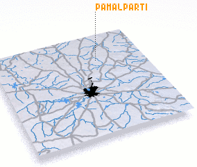 Places with similar names to Pāmalparti, India :: Disclaimer :: Information on this page comes without warranty of any kind |
||
|
Where is Pāmalparti? Elevation and coordinates ::
Latitude (lat): 17°46'12"N Longitude (lon): 78°41'40"E
Elevation (approx.): 590m (map arrows pan, magnifying glasses zoom) |
||
|
Visiting Pāmalparti? Hotel/Accommodation ::
Book a hotel in Pāmalparti Travel Guide ::
Buy a travel guide for India rental cars ::
car rental offers GPS waypoint ::
download a GPX waypoint (PoI) of Pāmalparti for your GPS receiver
|
||