|
search place name
|
||
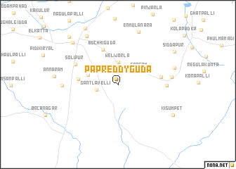
Papreddyguda (Andhra Pradesh, India)Papreddyguda is a town in the Andhra Pradesh region of India. An overview map of the region around Papreddyguda is displayed below.
regional and 3d topo map of Papreddyguda, India ::
Papreddyguda airports ::
The nearest airport is HYD - Hyderabad, located 53.3 km north east of Papreddyguda.
Other airports nearby include BEP - Bellary (252.7 km south west), Nearby towns ::
Welijorla (3.5km north) //
Gantlavelli (3.4km west) //
Sangam (4.0km north east) //
Kammadhanam (4.8km west) //
Buchhiguda (5.9km north) //
Chilkamari (6.1km west) //
Ellasenpet (6.6km east) //
Solīpur (7.2km north west) //
Tulanguda (7.5km east) //
Mangalguda (8.2km east) //
Rāikal (8.5km west) //
Enmulanara (8.9km north) //
Chantapalli (9.0km north west) //
Shadnagar (9.6km north west) //
Kisumpet (9.7km south east) //
Farrukhnagar (10.5km north west) //
[all distances 'as the bird flies' and approximate] 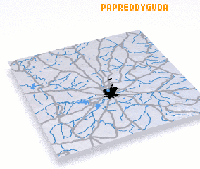 Places with similar names to Papreddyguda, India :: Disclaimer :: Information on this page comes without warranty of any kind |
||
|
Where is Papreddyguda? Elevation and coordinates ::
Latitude (lat): 17°0'37"N Longitude (lon): 78°16'15"E
Elevation (approx.): 629m (map arrows pan, magnifying glasses zoom) |
||
|
Visiting Papreddyguda? Hotel/Accommodation ::
Book a hotel in Papreddyguda Travel Guide ::
Buy a travel guide for India rental cars ::
car rental offers GPS waypoint ::
download a GPX waypoint (PoI) of Papreddyguda for your GPS receiver
|
||