|
search place name
|
||
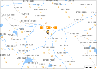
Pilgamma (Andhra Pradesh, India)Pilgamma is a town in the Andhra Pradesh region of India. An overview map of the region around Pilgamma is displayed below.
regional and 3d topo map of Pilgamma, India ::
Pilgamma airports ::
The nearest airport is HYD - Hyderabad, located 31.6 km north west of Pilgamma.
Nearby towns ::
Masidpur (1.1km east) //
Anājpur (1.6km south west) //
Lashkarguda (2.2km north west) //
Bātāsingāram (3.4km north east) //
Niralapalli (3.8km south east) //
Abdullapur (4.6km north) //
Polkampalli (6.1km south) //
Kawārpalli (6.8km north west) //
Yengalgudam (7.1km south) //
Nāganpalli (7.2km south) //
Koheda (7.4km west) //
Mailāram (8.0km south east) //
Rāipol (8.5km south) //
Ambarpet Kalān (8.2km north west) //
Tardmatipeta (8.9km north) //
Rāmdāspalli (9.4km south west) //
Mukunūru (9.6km south east) //
Chintalbhāwi (10.3km north east) //
Jagatpalli (10.8km north east) //
Kuntūr (10.8km north west) //
[all distances 'as the bird flies' and approximate]  Places with similar names to Pilgamma, India ::
// Pelkum (DE)
// Pelkum (DE)
// Palaiokómi (GR)
// Pawłokoma (PL)
// Paloquemao (CO)
// Palacamá (GT)
// Palagama (LK)
// Palagama (LK)
// Paligama (LK)
// Pallegama (LK)
Disclaimer :: Information on this page comes without warranty of any kind |
||
|
Where is Pilgamma? Elevation and coordinates ::
Latitude (lat): 17°16'52"N Longitude (lon): 78°42'16"E
Elevation (approx.): 433m (map arrows pan, magnifying glasses zoom) |
||
|
Visiting Pilgamma? Hotel/Accommodation ::
Book a hotel in Pilgamma Travel Guide ::
Buy a travel guide for India rental cars ::
car rental offers GPS waypoint ::
download a GPX waypoint (PoI) of Pilgamma for your GPS receiver
|
||