|
search place name
|
||
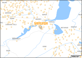
Sangrom (Jammu and Kashmīr, India)Sangrom is a town in the Jammu and Kashmīr region of India. An overview map of the region around Sangrom is displayed below.
regional and 3d topo map of Sangrom, India ::
Sangrom airports ::
The nearest airport is SXR - Srinagar, located 41.8 km south east of Sangrom.
Other airports nearby include RAZ - Rawala Kot Rawalakot (74.8 km south west), MFG - Muzaffarabad (87.2 km west), ISB - Islamabad Chaklala (143.3 km south west), IXJ - Jammu (176.8 km south), Nearby towns ::
Dārāi (0.0km north) //
Lālad (0.5km east) //
Buna Sīr (0.7km north east) //
Amargad (1.4km north east) //
Manz Sir (1.8km north west) //
Tailbal (2.8km north) //
Gūr Sīr (2.8km north west) //
Dogul Teng (3.2km north east) //
Mandi (3.0km north west) //
Bāghāt (3.5km north) //
Karinkshiwan (3.1km east) //
Batapur (3.1km east) //
Dara Nambal (3.1km east) //
Hamilun (3.7km north) //
Dobgāh (3.6km north west) //
Sharābbāgh (3.8km north west) //
Māzbug (3.9km north west) //
Dārapur (3.7km west) //
Ārampur (4.4km north) //
Adipur (4.3km north east) //
Vij (4.2km north west) //
Saiyid Shāhabuddīn (4.6km north west) //
Panzipur (4.4km east) //
Tārazu (4.6km north east) //
Lorihom (5.0km north west) //
Achhibal (4.9km north west) //
Ludur (4.6km west) //
Naupur (5.7km north) //
Chak Sultān Khān (5.6km north west) //
[all distances 'as the bird flies' and approximate]  Places with similar names to Sangrom, India ::
Disclaimer :: Information on this page comes without warranty of any kind |
||
|
Where is Sangrom? Elevation and coordinates ::
Latitude (lat): 34°15'0"N Longitude (lon): 74°27'0"E
Elevation (approx.): 1591m (map arrows pan, magnifying glasses zoom) |
||
|
Visiting Sangrom? Hotel/Accommodation ::
Book a hotel in Sangrom Travel Guide ::
Buy a travel guide for India rental cars ::
car rental offers GPS waypoint ::
download a GPX waypoint (PoI) of Sangrom for your GPS receiver
|
||