|
search place name
|
||
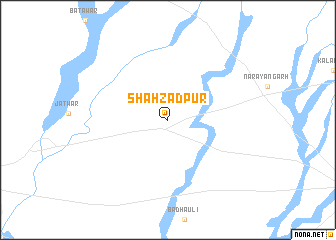
Shāhzādpur (Haryāna, India)Shāhzādpur is a town in the Haryāna region of India. An overview map of the region around Shāhzādpur is displayed below.
regional and 3d topo map of Shāhzādpur, India ::
Shāhzādpur airports ::
The nearest airport is IXC - Chandigarh, located 34.1 km north west of Shāhzādpur.
Other airports nearby include LUH - Ludhiaha Ludhiana (112.9 km north west), DED - Dehra Dun Dehradun (114.0 km east), KUU - Kulu Kullu Manali (158.6 km north), DEL - Delhi Indira Gandhi Intl (208.9 km south), Nearby towns ::
[all distances 'as the bird flies' and approximate] 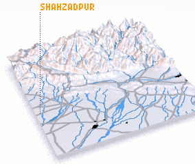 Places with similar names to Shāhzādpur, India ::
// Shāhzadapur (BD)
// Shāhzādpur (BD)
// Shahzādpur (IN)
// Shahzādpur (IN)
// Shāhzādpur (IN)
// Shāhzādpur (IN)
// Shāhzādpur (PK)
Disclaimer :: Information on this page comes without warranty of any kind |
||
|
Where is Shāhzādpur? Elevation and coordinates ::
Latitude (lat): 30°27'0"N Longitude (lon): 77°2'0"E
Elevation (approx.): 309m (map arrows pan, magnifying glasses zoom) |
||
|
Visiting Shāhzādpur? Hotel/Accommodation ::
Book a hotel in Shāhzādpur Travel Guide ::
Buy a travel guide for India rental cars ::
car rental offers GPS waypoint ::
download a GPX waypoint (PoI) of Shāhzādpur for your GPS receiver
|
||