|
search place name
|
||
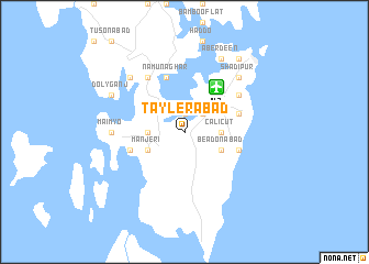
Taylerābād (Andaman and Nicobar Islands, India)Taylerābād is a town in the Andaman and Nicobar Islands region of India. An overview map of the region around Taylerābād is displayed below.
regional and 3d topo map of Taylerābād, India ::
Taylerābād airports ::
The nearest airport is IXZ - Port Blair, located 5.6 km north east of Taylerābād.
Nearby towns ::
Bumlitan (1.9km north) //
Garacherāma (2.6km north east) //
Protheroepur (2.6km north east) //
Calicut (3.6km east) //
Homfrayganj (3.6km west) //
Beadonābād (4.1km south east) //
Manjeri (4.1km south west) //
Manglutān (5.8km west) //
Rangachāng (5.8km east) //
Birchganj (5.8km east) //
Brookesābād (5.8km east) //
Namūnaghar (5.8km north) //
Austinābād (6.6km north east) //
Mitha Khari (6.6km north west) //
Hastmatābād (7.3km west) //
Maimyo (7.3km west) //
Hobdaypur (7.8km north west) //
Shādipur (7.8km north east) //
Aberdeen (8.3km north east) //
Hope Town (8.3km north east) //
Jangli Ghāt (8.3km north east) //
Dolyganj (8.2km north west) //
Port Blair (9.2km north east) //
[all distances 'as the bird flies' and approximate] 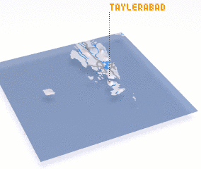 Places with similar names to Taylerābād, India ::
// Delī Robāţ (IR)
// Tall Arbāţ (SY)
Disclaimer :: Information on this page comes without warranty of any kind |
||
|
Where is Taylerābād? Elevation and coordinates ::
Latitude (lat): 11°36'0"N Longitude (lon): 92°42'0"E
Elevation (approx.): 6m (map arrows pan, magnifying glasses zoom) |
||
|
Visiting Taylerābād? Hotel/Accommodation ::
Book a hotel in Taylerābād Travel Guide ::
Buy a travel guide for India rental cars ::
car rental offers GPS waypoint ::
download a GPX waypoint (PoI) of Taylerābād for your GPS receiver
|
||