|
search place name
|
||
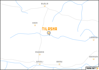
Tilāsma (India)Tilāsma is a town in India. An overview map of the region around Tilāsma is displayed below.
regional and 3d topo map of Tilāsma, India ::
Tilāsma airports ::
The nearest airport is KTU - Kota, located 52.7 km east of Tilāsma.
Other airports nearby include UDR - Udaipur (153.5 km west), JAI - Jaipur (200.5 km north), Nearby towns ::
 Places with similar names to Tilāsma, India ::
// Dalasam (IR)
// Dlisem (ID)
// Tolesem (GH)
// Tulasimba (TZ)
// Ţelesm (IR)
// Tall ‘Iz̧ām (SY)
// Tʼelezam (ET)
// Dala Samba (AO)
Disclaimer :: Information on this page comes without warranty of any kind |
||
|
Where is Tilāsma? Elevation and coordinates ::
Latitude (lat): 25°4'0"N Longitude (lon): 75°20'0"E
Elevation (approx.): 485m (map arrows pan, magnifying glasses zoom) |
||
|
Visiting Tilāsma? Hotel/Accommodation ::
Book a hotel in Tilāsma Travel Guide ::
Buy a travel guide for India rental cars ::
car rental offers GPS waypoint ::
download a GPX waypoint (PoI) of Tilāsma for your GPS receiver
|
||