|
search place name
|
||
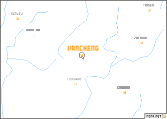
Vancheng (Mizoram, India)Vancheng is a town in the Mizoram region of India. An overview map of the region around Vancheng is displayed below.
regional and 3d topo map of Vancheng, India ::
Vancheng airports ::
The nearest airport is AJL - Aizwal Aizawl, located 41.9 km north west of Vancheng.
Other airports nearby include IXH - Kailashahar (142.5 km north west), IXS - Silchar (164.0 km north), IMF - Imphal (171.2 km north east), CGP - Chittagong Shah Amanat Intl (181.3 km south west), Nearby towns ::
Lungpho (5.8km south) //
[all distances 'as the bird flies' and approximate] 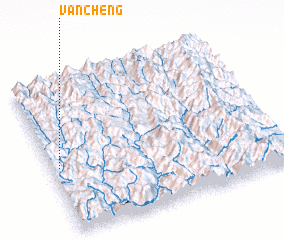 Places with similar names to Vancheng, India ::
// Vanchenki (RU)
// Fanchiniko (GH)
// Fen-ch'ang (TW)
// Van Chàng (VN)
// Vẩn Chàng (VN)
// Van Chung (VN)
// Văn Chương (VN)
// Fanchang (CN)
// Fancheng (CN)
// Fanchong (CN)
Disclaimer :: Information on this page comes without warranty of any kind |
||
|
Where is Vancheng? Elevation and coordinates ::
Latitude (lat): 23°26'0"N Longitude (lon): 93°2'0"E
Elevation (approx.): 1066m (map arrows pan, magnifying glasses zoom) |
||
|
Visiting Vancheng? Hotel/Accommodation ::
Book a hotel in Vancheng Travel Guide ::
Buy a travel guide for India rental cars ::
car rental offers GPS waypoint ::
download a GPX waypoint (PoI) of Vancheng for your GPS receiver
|
||