|
search place name
|
||
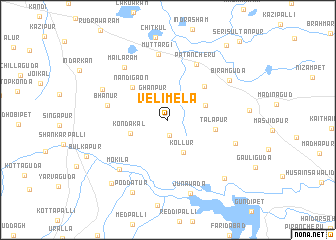
Velimela (Andhra Pradesh, India)Velimela is a town in the Andhra Pradesh region of India. An overview map of the region around Velimela is displayed below.
regional and 3d topo map of Velimela, India ::
Velimela airports ::
The nearest airport is HYD - Hyderabad, located 24.7 km east of Velimela.
Nearby towns ::
Idulnāgalapalli (1.7km south) //
Ghanpur (2.9km north west) //
Kollūr (4.0km south east) //
Kondakal (4.3km west) //
Mandmūl (4.3km north east) //
Nandigaon (5.3km north west) //
Talāpur (5.2km east) //
Kāsāreddipalli (5.4km north east) //
Bhānūr (6.6km west) //
Patancheru (6.9km north east) //
Muttargi (7.4km north) //
Mailāram (7.5km north west) //
Mokila (7.6km south west) //
Gopanpalli (7.6km east) //
Kāsāram (7.8km north west) //
Biramguda (7.9km north east) //
Junawāda (8.6km south) //
Poddatūr (8.9km south west) //
Wati Nāgalapalli (8.8km south east) //
Tangatūr (9.3km south west) //
Krishnareddipet (10.5km north east) //
Seri Sultānpur (11.6km north east) //
[all distances 'as the bird flies' and approximate] 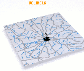 Places with similar names to Velimela, India ::
Disclaimer :: Information on this page comes without warranty of any kind |
||
|
Where is Velimela? Elevation and coordinates ::
Latitude (lat): 17°28'32"N Longitude (lon): 78°14'11"E
Elevation (approx.): 547m (map arrows pan, magnifying glasses zoom) |
||
|
Visiting Velimela? Hotel/Accommodation ::
Book a hotel in Velimela Travel Guide ::
Buy a travel guide for India rental cars ::
car rental offers GPS waypoint ::
download a GPX waypoint (PoI) of Velimela for your GPS receiver
|
||